Scotland. The Isle of Skye is famous for its breathtaking scenery. Areas like the Cuillins or the Quairang make the island the perfect place for hiking enthusiasts and nature lovers. With rugged sea cliffs, spectacular rock towers, and green hills, Skye invites you to go on extended tours. In this post, I'll show you nine of my favorite hikes on the Isle of Skye and tell you what to expect. From an easy walk to a multi-day trail, there's something for everyone.
Unassigned, unpaid advertising. The article contains affiliate links.
Content
#1 The Classic of Skye - The Old Man of Storr
#2 Brother's Point - on the Tracks of the Dinosaurs
#3 Quiraing - perhaps the most beautiful Hike on the Isle of Skye
#4 Fairy Tale World - the Fairy Glen
#5 White Coral Beaches of Claigan - Caribbean Feeling in Scotland
#6 Neist Point - Skye's most beautiful Sea Cliffs and Orca Hotspot
#7 The "Bad Step" and the Cuillins - from Kilmarie to Sligachan
#8 Getting Lost - for Pathfinders from The Storr Loch Dam to Portree
#9 For long Distance Hikers - the Skye Trail
#1 The Classic of Skye - The Old Man of Storr
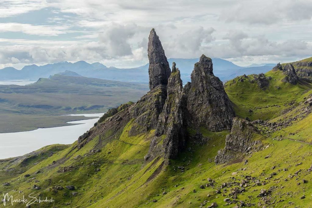
The Old Man of Storr is the landmark of the Isle of Skyeand must not be missed on any visit to the island. Unfortunately, it is also very crowded here. Therefore, a visit in the early morning hours or in the evening is particularly suitable. In the evening, however, it can be a bit shady, as the sun is then behind the mountains. Many visitors come up the steep path from the parking lot to the viewpoint, take a photo and then go back to the car. This is a pity, because there are so many beautiful views to discover here on a wide variety of trails. Paths that even lead up to the foot of the Old Man of Storr.
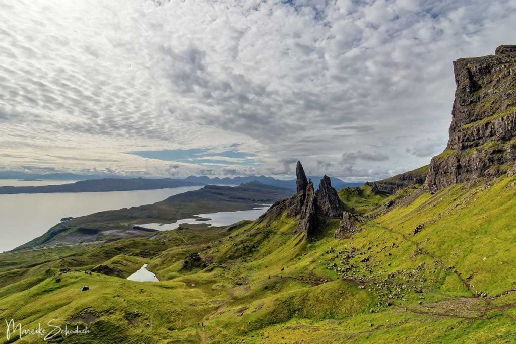
The Storr is a plateau about 719 meters high. The bizarre towers, needles and rock sculptures at the foot of the Storr were formed by a landslide. entstanden. Einer der Türme ist die 535 Meter hohe Felsnadel “Old Man of Storr”.
Length: To the first viewpoint about 2 kilometers with a steep ascent. The length of the walk can be extended at will, as there is an extensive network of paths between the rocks.
Duration: at least 1.5 hours
Highlights:Rock needle Old Man of Storr from various vantage points.
Access and parking: The pay and display parking lot on the A855 at the foot of the Old Man of Storr cannot be missed.
#2 Brother's Point - on the Tracks of the Dinosaurs
They are not easy to find. But they are said to exist at several places on the Isle of Skye: fossilized footprints of dinosaurs.One of the places where you can find dinosaur tracks is Brother's Point. There are said to be more than a dozen prints here. However, they can be seen only at low tide, when the water has receded from the sandstone cliffs.

Unfortunately, even after a long search and with a lot of imagination, we could not discover any dinosaur tracks. Maybe you have more luck.

Tip: Tip: Visit the Dinosaur Museum in Staffin and ask about the dinosaur tracks. There are also guided tours to the footprints on the beach. However, when we were there, the museum was unfortunately closed for Covid-19 and the tours did not take place.
But the dinosaur tracks were quickly forgotten, because the walk has more to offer. From the flat coast we follow the path up the cliff. The path narrows and eventually bends to the left onto a dramatic headland - Brother's Point - or Rubha nam Brathairen in Gaelic. You can climb to the highest point of the headland and be rewarded with a magnificent view all the way to Kilt Rock in the north.

The excursion to Brother's Point is varied and also perfect for a leisurely afternoon with a small picnic. The walk is not overly strenuous but memorably scenic. And best of all, it's not crowded even on nice summer days.
Length: about 4 kilometers
Duration: at least 1.5 hours
Highlights:Dinosaur tracks; Brother's Point headland; varied coastal landscape
Access and parking: Parking bay on the A855 north of the village of Culnacnoc. The footpath branches off on the opposite side of the road. GPS: 57°35'05.4″N 6°09'28.4″W
#3 Quiraing - perhaps the most beautiful Hike on the Isle of Skye
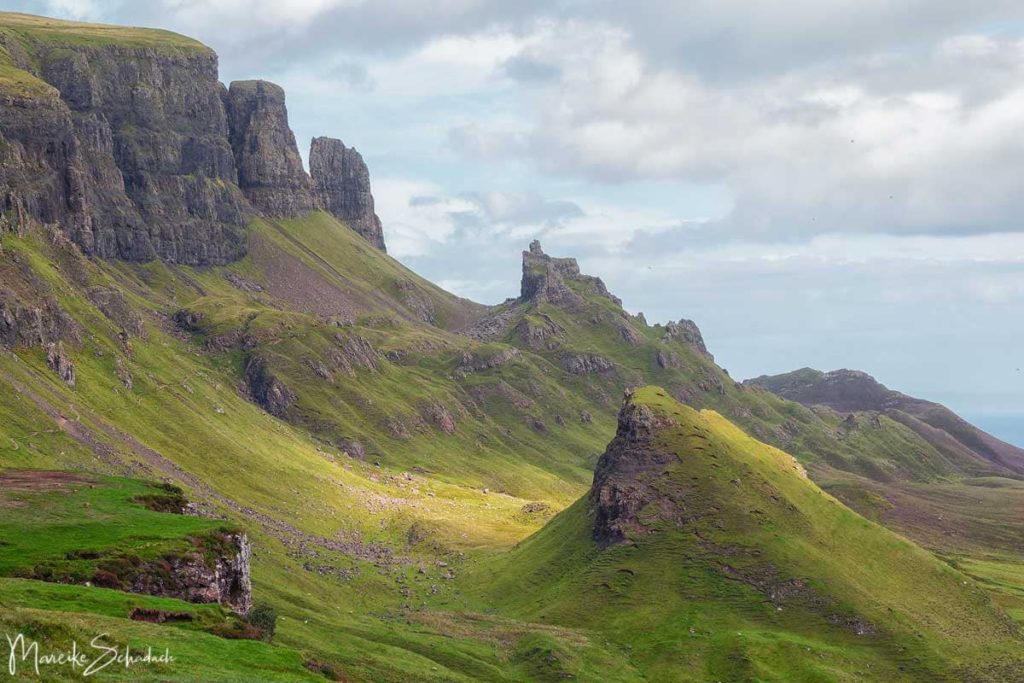
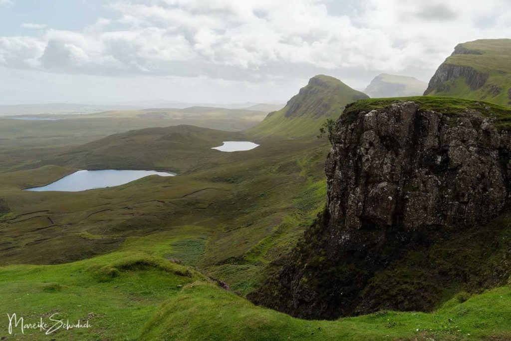
Having already seen the Old Man of Storr, I thought there can be nothing better. But when I was standing at the parking lot of the Quiraing, I knew I was wrong. Mother Nature has outdone herself here with a gigantic rockfall.
Even the access road is spectacular. It winds up the flank of the mountain range in serpentine lines. Behind every bend, a new view opens up, leaving you in awe. The same is true of the hiking trail. I had to keep stopping and turning around - after all, I didn't want to miss any of these fantastic views.

At the parking lot, a map gives an overview of the hiking routes. A nice round trip leads you along the upper edge of the cliffs to the rock needles and back along the flank of the cliffs. However, it is better not to walk the upper section in fog or strong winds. We did not walk it, because the wind almost blew me away.
Safety First: Be prepared for sudden weather changes on EVERY hike on the Isle of Skye. Take rain gear and warm clothes, wear sturdy boots, don't forget your map, compass and GPS (or your GPS-enabled cell phone with offline map). Also pack a picnic and enough drinking water. Depending on the season, you may also want to bring bug spray and sunscreen. A first aid kit should also be in your backpack.
Length: about 6.5 kilometers
Duration: 2 to 3 hours
Highlights:spectacular views over the Trotternish Peninsula
Access and parking: Between Brogaig and Stenscholl turn west off the A855 towards Quiraing. Parking is available at the start of the Quiraing Walk. GPS: 57°37'41.9″N 6°17'23.8″W
#4 Fairy Tale World - the Fairy Glen
If there are elves and fairies anywhere on the Isle of Skye, it is certainly in the Fairy Glen – dem “Elfen Tal”Fairy Glen. Green hills line the Fairy Glen and are crisscrossed by a network of walking paths. The Glen seems a bit like a man-made fantasy landscape, I've never seen anything quite like it. It's a perfect place to drift along, discovering new fantastic views all the time. Especially impressive is the free-standing rock "Castle Ewen",which you can even climb.

Don't confuse the Fairy Glen with the Fairy Pools. The Fairy Pools are a string of natural pools and waterfalls, but they are extremely crowded in the summer when the weather is good.
Length: variable
Duration: variable
Highlights:Fairy landscape of green hills; Castle Ewen
Access and parking: Coming from the south, a single track road branches off to the right just before the village of Uig. Follow it for about 2 kilometers to the parking area. GPS: 57°35'01.9″N 6°19'52.9″W

#5 White Coral Beaches of Claigan - Caribbean Feeling in Scotland
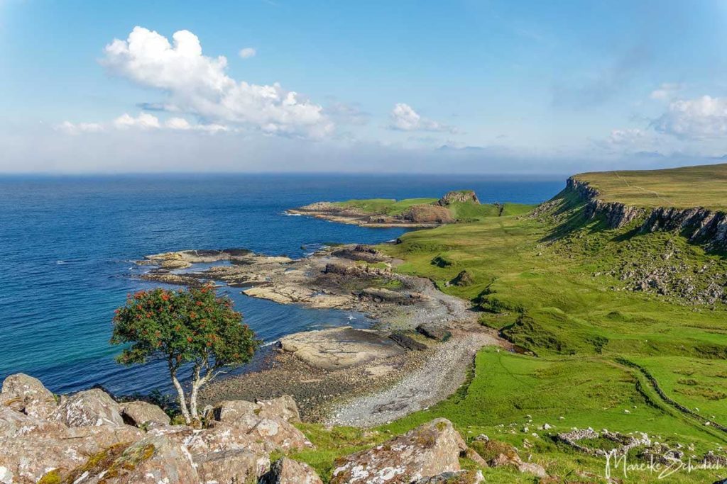
The coast of the Isle of Skye consists mainly of spectacular cliffs. But again and again the rugged cliffs are interrupted by sandy beaches. Among the most beautiful beaches on Skye are the white coral beaches at Claigan.
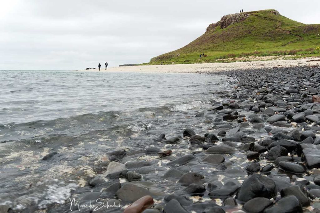
From the end of the parking lot, follow the path towards the coast. At Camas Ban you will finally reach a first bay. However, this one has only a few sandy areas. Follow the path to the right through a gap in the dry stone wall over a small hill. At the top you will see the white coral beach - a great sight. But even more beautiful is the view of the beach when you climb the small hill Cnoc Mor a Ghrobain behind the beach. The way back is the same way.
Length: about 4 kilometers
Duration: 1-2 hours
Highlights:View over white beach
Access and parking: The road ends at the parking lot in Claigan, north of Dunvegan Castle. There is not much room though. GPS: 57°29'20.7″N 6°37'13.5″W

#6 Neist Point - Skye's most beautiful Sea Cliffs and Orca Hotspot
The cliffs at Neist Point, the westernmost headland on the Isle of Skye,are the most beautiful on the island. The steep cliffs with the photogenic lighthouse at the top jut far out into the sea. Down at the foot of the cliffs the thunderous waves break, spray splashes into the air. At Neist Point, an epic view awaits you from the View Point, as well as a six-kilometer walk to the tip of the headland. Along the way, you'll see the remains of an old cable car station and an old jetty with a small crane.Both facilities used to supply the lighthouse with supplies. However, the lighthouse is now abandoned and is operated automatically from a distance.
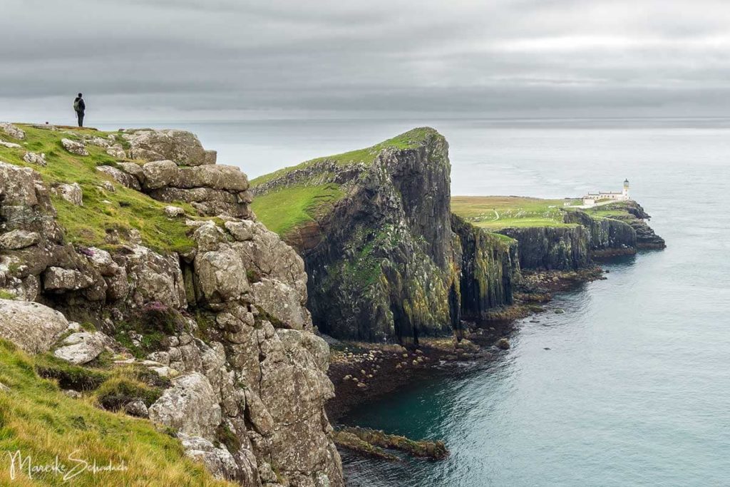
Tip: Take binoculars with you, because with a little luck you can watch whales and dolphins here. Neist Point is considered the orca hotspot of Skye.It must be especially beautiful here at sunset .
Read more in my separate article Neist Point - Most beautiful cliffs on Skye and Orca Hotspot.
Length: about 6 kilometers
Duration: about 2 hours
Highlights:Panoramic view of the most beautiful sea cliffs of Skye; lighthouse; gannets; orca and dolphin watching possible
Access and parking: From Dunvegan take the single track road B884 towards Gleann Dail (Glendale). Just before Milovaig a small road branches off to Waterstein and Neist Point. There is a parking area at the end of the road. There are also other marked parking spaces on the side of the access road. GPS: 57°25'46.8″N 6°46'44.9″W.
Another tip: Not far from Neistpoint you can get super tasty vegetarian food at Chidakasha Skye restaurant.
Guided Tours on the Isle of Skye
You don't feel like wandering around on your own and would rather join a guided tour? Nothing could be easier. If you book an excursion via the following affiliate links, you will support Wanderlust Motifs with a small commission. The tour will not be more expensive for you. Merci!
#7 The "Bad Step" and the Cuillins - from Kilmarie to Sligachan
The hike in the heart of the Cuillins is one of the most beautiful but also most strenuous I have done on Skye. And also one of the most adventurous. Because the route from Kilmarie to Sligachan leads over the famous "Bad Step". Behind this mysterious name is a 60° inclined rock plate, which blocks the coastal path and has already brought some hikers to turn back.

But those who have overcome the Bad Step will be richly rewarded. For the coastal scenery is fantastic and Loch Coruisk is said to be the most beautiful on the Isle of Skye. The hike is so varied and beautiful that I wrote a separate article: How bad is the "Bad Step"? All Info about the Hike from Kilmarie to Sligachan.
Alternativ: If you prefer not to walk the "Bad Step", you have the possibility to follow an easier path to Sligachan. This passes Loch na Creitheach and also avoids the river crossing and the crossing of the pass at 295 meters above sea level.
Length: about 25 kilometers
Height difference: about 500 meters
Duration:7 - 9 hours
Highlights:great coastal hike with small climbs; river crossing; Loch Coruisk; Bay
of Camasunary; old bridge at Sligachan
Access and parking: Starting point is the Camasunary Car Park near Kilmarie on the road from Broadford to Elgol. Alternatively you can start the walk in the village of Elgol. GPS: 57°10'46.5″N 6°03'48.4″W

#8 Getting Lost - for Pathfinders from The Storr Loch Dam to Portree
The hike from "The Storr Loch" dam to Portree is a little adventure. And also one of the most beautiful longer hikes we have done on the Isle of Skye.
The tour starts at the parking lot of the Storr Loch Dam (Loch Leatharn Dam) and leads along the coast to the charming town of Portree. After about 500 meters you come to a house, here you turn left to the viewpoint Bearreraig Bay where you can see an old hydroelectric power station .

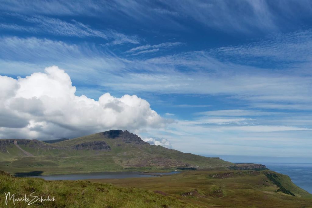
The route continues through moorland along the coastal cliffs.There is no path, at best a few sheep tracks, but they quickly get lost in the lush green of the moorland. The views back to The Storr and Trotternish Ridge are fantastic, as are the views over the coastal ridge ahead and the Isle of Raasay. The highest point of the walk is Sithean Bhealaich Chumhaing (392 m). From here you will go downhill on a trail until you reach several cattle pastures. You have to cross them until you reach the town of Portree via the Scorrybreac Trail along the shore.
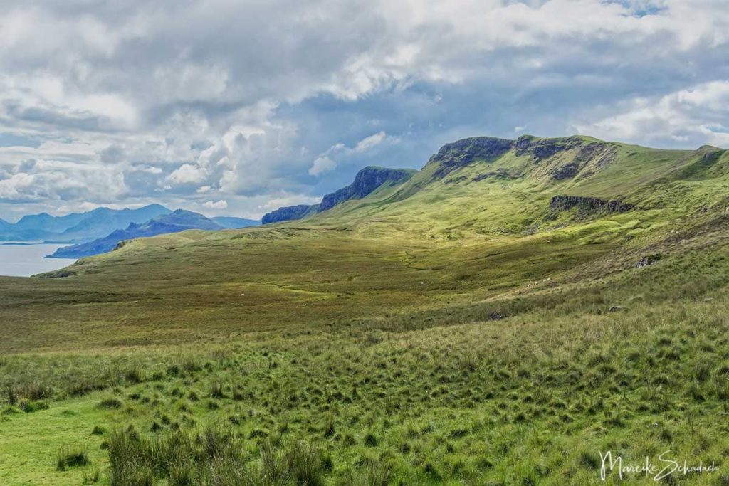
Tip: The terrain in the moorland is extremely uneven. In the high grass, however, you do not see the unevenness. trekking poles give you the necessary stability and also protect you from twisting your ankle.
During the hike we did not meet any other people. Only on the last part shortly before Portree we met three hikers. The nature experience was perfect, in addition with super weather. As company there were far and wide only curious sheep. But from them we felt at times observed from all sides.
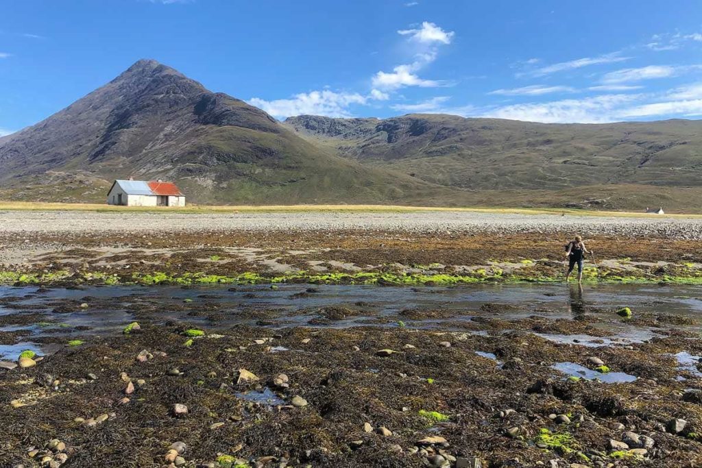
Attention: The route is very exposed and not recommended in bad weather / poor visibility. Since there is no path, you have to find the route yourself. This is best done when you can see the hills and cliffs. Because otherwise you will quickly end up in a dead end, where a steep drop makes it impossible to continue. But even in good weather you should have map, compass and GPS with you and know how to use them.
Length: about 13,6 kilometers; about 397 meters of altitude difference
Duration: 6-8 hours
Highlights:Views over spectacular sea cliffs; Bearreraig Bay viewpoint; old hydroelectric power station; solitude in trackless terrain
Directions to get there: It's best to have a cab take you from Portree to "The Storr Loch" dam.

#9 For long Distance Hikers - the Skye Trail
For those who can't get enough of hiking, there is the Skye Trail. This long distance trail is a challenging hike through the breathtaking landscape of the Isle of Skye. The route goes for 128 kilometers partly through difficult terrain with steep paths and slopes. But if you take on the trail, you'll be rewarded with spectacular mountain and coastal scenery and, if you're lucky, you may even spot wildlife.

The hike goes in 7 stages from Broadford in the south to Rubha Hunish in the northof the Isle of Skye. The sections are quite different: One time there are only paths of sheep (or not even that) and you have to find your own way. And the other time you are with many other visitors on well-trodden paths.
But it is the mixture that makes the trail interesting. In addition, the Skye Trail includes some of the most beautiful walks on the Isle of Skye, such as the Cuillins, the Old Man of Storr or the Quairang.
For the Skye Trail you should have experience in using GPS, map and compass. Some sections are not recommended in fog. For example, the section between Portree and the Old Man of Storr runs along almost unvisited coastal cliffs partly without a path.

You can find more information here.
Tip: It's best to walk the trail from south to north - then the landscape becomes more impressive with each stage.
There is access by public transport and accommodation at the end of each stage. The hike can also be done very well as a camping trip with a combination of campsites and wild camping. However, we took it a bit easy and walked the Skye Trail with the support of MACs Adventures. This provided us with luggage transport as well as a shuttle to the starting points of the stages or to our accommodations.
Length: about 128 kilometers
Duration: at least 7 days
Highlights:Partly hiking off the beaten track; Cuillins with the infamous Bad Step (alternative route possible); Old Man of Storr and Quairang
Book Recommendations for the Isle of Skye
Do you want to know where the journey is going? Then I can recommend this travel guides* to you.
You can order the travel guides on Amazon by clicking on the pictures. If you buy a product via an affiliate link, I get a small commission, and you help me to keep filling Fernweh-Motive with interesting articles. The product will not be more expensive for you, and you will do me a huge favor.
Which hike on the Isle of Skye did you like best? Do you have any questions or suggestions about my article? If yes, then write me a comment!
Do you want to know when there are new articles on my blog? Then follow me on Facebook, Pinterest or Instagram. I would also be very happy if you share my article with your friends.
Recommendations for further Reading
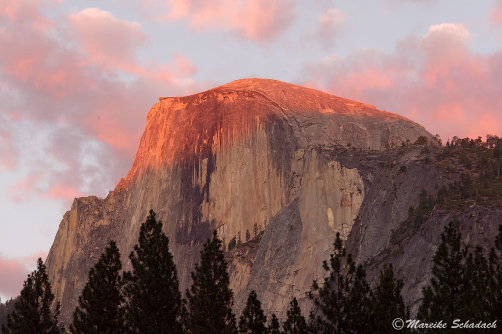
Do you love the outdoors as much as I do? Then you might also be interested in my articles about a Panoramic Hike to the Hjörleifshöfði in the South of Iceland or about the Climbing the Half Dome in Yosemite National Park.




Tippitoppi! vielen Dank!