Iceland. After two hours, I had almost gotten used to the constant uphill walking. It felt almost funny when I saw a wide plain in front of me. A minute ago everything around me was green, here it is now stony and windy. In the distance I recognized a cairn. It had to be huge. Shortly after, I kept the stone man company for a while and enjoyed the panoramic view of the surrounding glaciers and canyons from the Fimmvörðuháls Trail, one of the most beautiful trekking routes in Iceland.
Unassigned, unpaid advertising. The article contains affiliate links.
Thor's forests, dizzying views, canyons, glaciers, white snowfields, black lava formations, volcanic craters and countless waterfalls.... Did I forget something?
Von Þórsmörk (Básar) bis nach Skógar sind es rund 25 Kilometer und 870 Höhenmeter bergauf. Der Weg geht steil hinauf bis zum Fimmvörðuháls, wo die Hütten Fimmvörðuskáli und Baldvinsskáli stehen. Von dort geht es dann nicht ganz so steil rund 1060 Höhenmeter wieder hinab. Viele Wanderer, die den beliebten Laugarvegur Trail gehen, setzten ihre Wanderung über den Fimmvörðuháls Trail bis nach Skogar fort. Die Strecke lässt sich in zwei Etappen mit Übernachtung bzw. Camping in/an der Hütte unterteilen. Für mich war es ebenso die Fortsetzung des Laugarvegur und zugleich der krönende Abschluss einer meiner schönsten Wandertouren. Ich bin beide Etappen des Fimmvörðuháls an einem Tag gelaufen, anfangs bei schönstem Sonnenschein. Abends um 23 Uhr kam ich bei Regen in Skogar an. Der Zeltplatz war voll, meine Beine waren müde, meine Füße waren nass, meine Nase lief, aber ich hatte ein breites Grinsen im Gesicht.
Stages of the Fimmvörðuháls Trail
Stage 1: Þórsmörk (Básar) - Fimmvörðuháls (ca. 10,5 km; ascent ca. 1220 m, descent ca. 259 m)
Stage 2: Fimmvörðuháls - Skógar (approx. 14 km; descent approx. 1060 m)
Where is the Fimmvörðuháls Trail the most beautiful?
The Fimmvörðuháls Trail gives you a little bit of everything Iceland has to offer. It's hard to say which section I liked best. The trails are very different and it is the variety that makes the trail. It never gets boring.
Forests of Thor and dwelling place of the gods
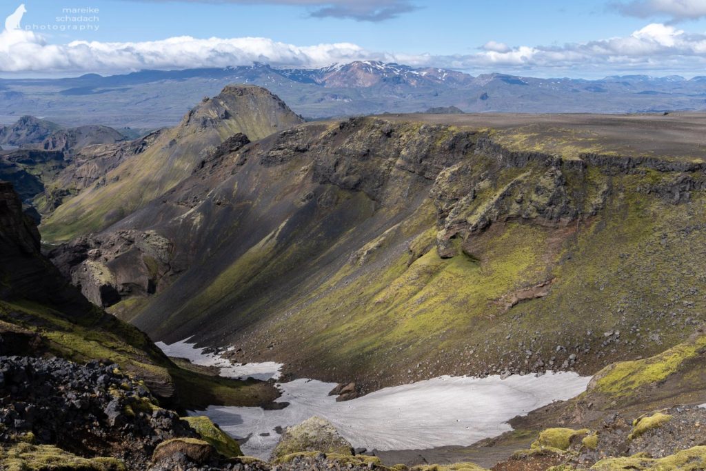
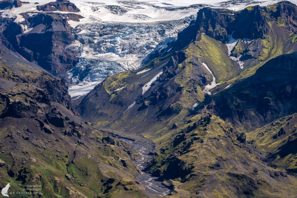
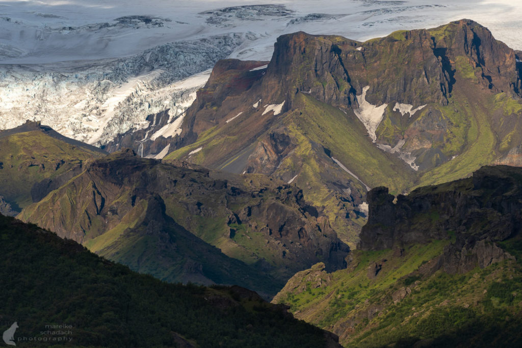
It starts in the forests of Thor - also known as Þórsmörk. Here blue and yellow flowers bloom, there is water and the dwarf birches grow lush and don't seem so dwarfish anymore. The path zigzags up through Goðalönd, the dwelling place of the gods, to several viewpoints. From here the valley of the wide glacial river Krossa can be seen for a long time. Soon, the path becomes more exposed. On both sides deep canyons cut into the landscape and there is a great view of the mountain Útigönguhöfði and the glacier Tungnakvíslajökull on the other side. Up here, no more trees grow and it goes steeply up a grass-covered mountain flank further and further.

View to the valleys Hvannargil and Hraungil
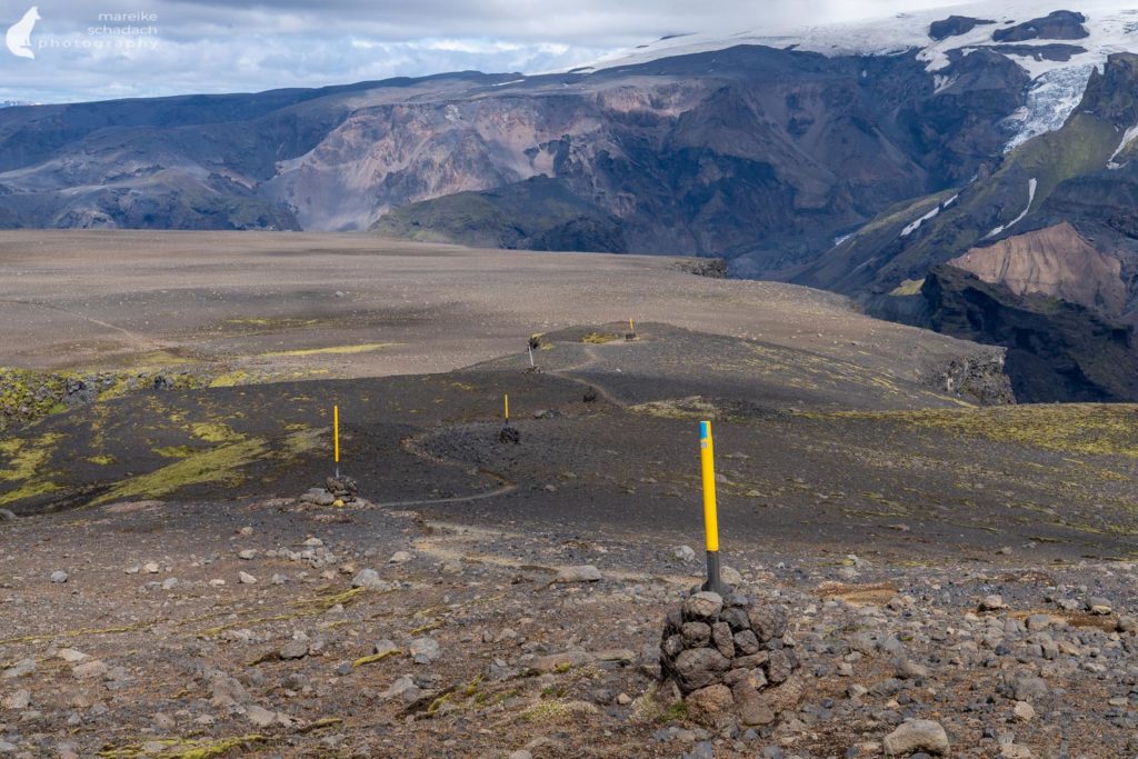
After the steep ascent it is time for a rest. The path leads straight across the stony plain of the plateau mountain Morinsheiði at the end of which the next highlight is waiting: the view into the valleys Hvannargil and Hraungil. A great point for an extensive break and to gather strength. Now we go up a narrow section at Heljakambur, it gets a bit steeper again and at an easy climbing spot there is even a metal chain for safety.

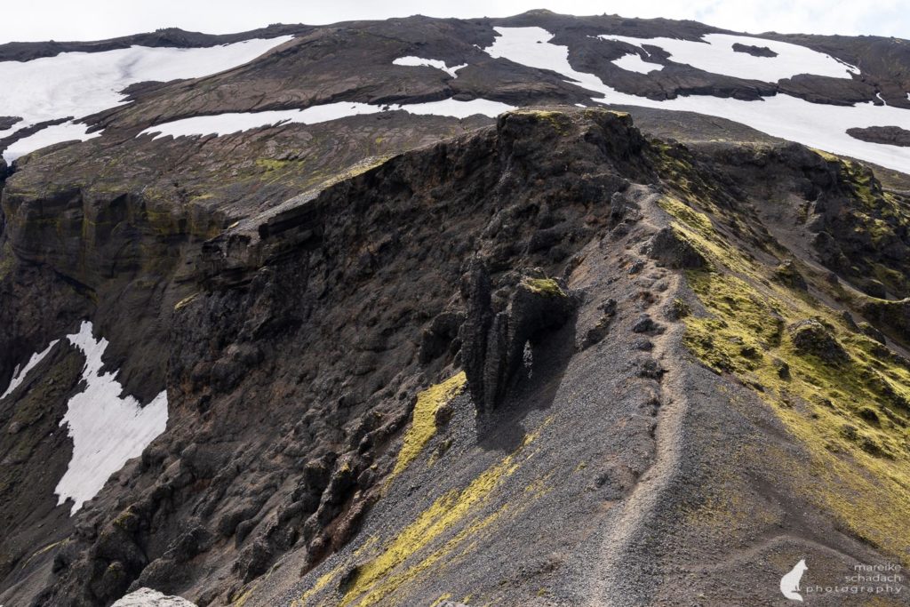


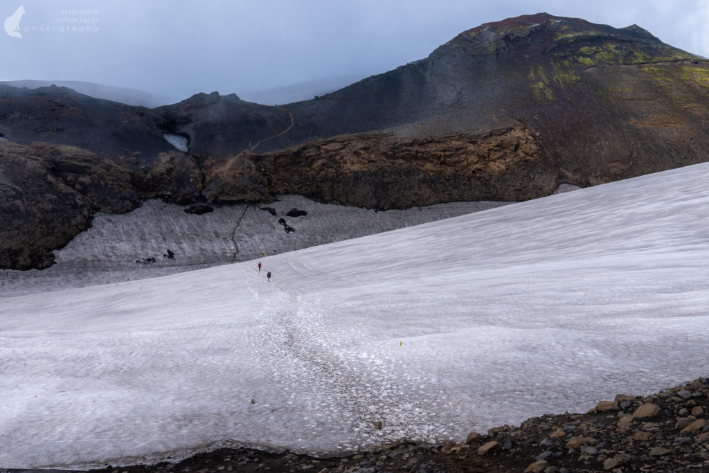
Snow and lava fields
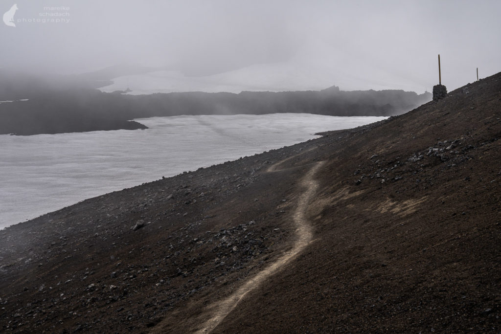
Now it goes further and further up to the lava field Godahraun. At some point the first snow fields begin and the colors of the landscape reduce to black, white and gray. From time to time there is also some red mixed in, from the lava rock underneath. Here Eyjafjallajökull erupted in 2010, the craters Magni and Modri erupted before the main crater. By now the lava has cooled down a long time ago, but it is still sharp and cuts your skin or rain pants if you are not careful. The trail continues between the Eyjafjallajökull and Myrdalsjökull volcanoes. At the 1116 meter high pass Fimmvörðuháls it is almost done. At least for those who plan to spend the night at the huts.


Trail of the waterfalls
Two huts at the pass invite you to stay, camp or just to warm up for a while. From here the view reaches all the way to the coast. Afterwards the trail leads over a gravel road. Only at the bridge, which leads over the river Skógá, it continues on a trail - I have called this section for me the "Trail of the waterfalls". The waterfalls line up like pearls on a necklace - one more beautiful than the other. Especially when the sky is a bit more dramatic, the photos become especially beautiful. Unfortunately, this is then also often associated with rain, so I mostly just took pictures with my phone. Next to the waterfalls, steep canyons open up that can even keep up with the picturesque Múlagljúfur Canyon in southeast Iceland.

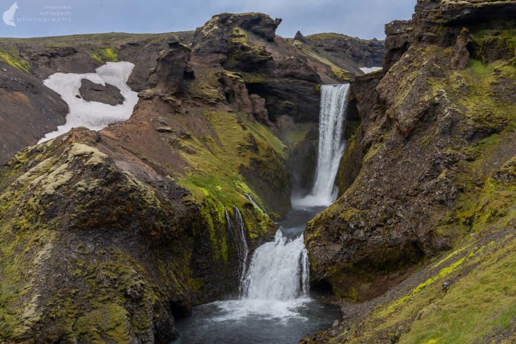
Even though this last section is incredibly beautiful, it also drags on quite a bit. Especially when you have already covered 20 kilometers. The trail ends at the impressive Skógafoss - but only after you have mastered the last challenge: about 370 steps down to the campsite.
Tip: After the bridge over the Skógá River, you'll find several springs along the trail where you can refill your drinking water.


The Fimmvörðuháls Trail at a glance
Start and end: Básar (247 m) in Þórsmörk via Fimmvörðuháls (1116 m) to Skogar (60 m)
Length: about 25 kilometers
Height difference: Direction Þórsmörk to Skogar about 870 meters up and 1060 meters down
Tip: It is easier to go steep up than steep down, so for me the direction Þórsmörk to Skógar was the favorite.
Overnight: In two cabins at Fimmvörðuháls (book in advance) or in a tent next to the cabins. Wild camping is prohibited. At the start/end point at campsites or hotel (Skógar) or hut (Þórsmörk).
Directions to get there: from / to Þórsmörk or Skógar Campsite there are buses. You can book in advance through Trex. Attention: If you take the bus from Skógar to Reykjavik, you will have to stay in Hvolsvöllur for about six hours. There is not much to see here, except the gas station with restaurant, a few Icelandic horses, a souvenir store and the lava exhibition. Alternative: the Straeto bus from Skogar. Bookings in advance are not possible. If the bus is full, you will have to wait for the next one, which will come the next day.
Do not forget: Trekking poles, sunglasses and sunscreen, rain gear and warm clothes (no matter what the weather is at the beginning!!!), gloves, hat, first aid kit with emergency blanket.
Check the weather forecast! If you are hiking at the beginning of the season, check the condition of the trail, for example on Safetravel.is. Do not start the tour in bad weather / forecast. You walk mostly in exposed terrain, where you have no protection in bad weather and also miss the view - not worth it. It is better to stay one day longer in the camp. Plan a reserve day, if necessary instead smaller day tour in Þórsmörk!
The best Season: mid July - early September
Trail conditions: trails, scree, snow and lava fields, gravel road. In July 2022 I didn't have to ford any rivers from Þórsmörk Langidalur to Básar, the Krossa was crossable dry with mobile bridge. However, it is better to ask about the current status beforehand.
Drinking water: There are hardly any places on the way where you can fill up. However, you can melt snow at the top of the pass or buy drinks at the huts.
Map: Landmannalaugar, Porsmörk, Fjallabak - 1:100.000 *
Orientation: the trail is marked throughout with pegs
Book Recommendations for Iceland
Do you want to know where the journey is going? Then I can recommend this travel guides* to you.
You can order the travel guides on Amazon by clicking on the pictures. If you buy a product via an affiliate link, I get a small commission and you help me to keep filling Fernweh-Motive with interesting articles. This does not make the product more expensive for you.


Do you know the Fimmvörðuháls Trail in Iceland? How did you like it? Do you have any questions or suggestions to my article? If yes, then write me a comment!
Do you want to know when there are new articles on my blog? Then follow me on Facebook, Pinterest or Instagram. I would also be very happy if you share my article with your friends.

Recommendations for further Reading
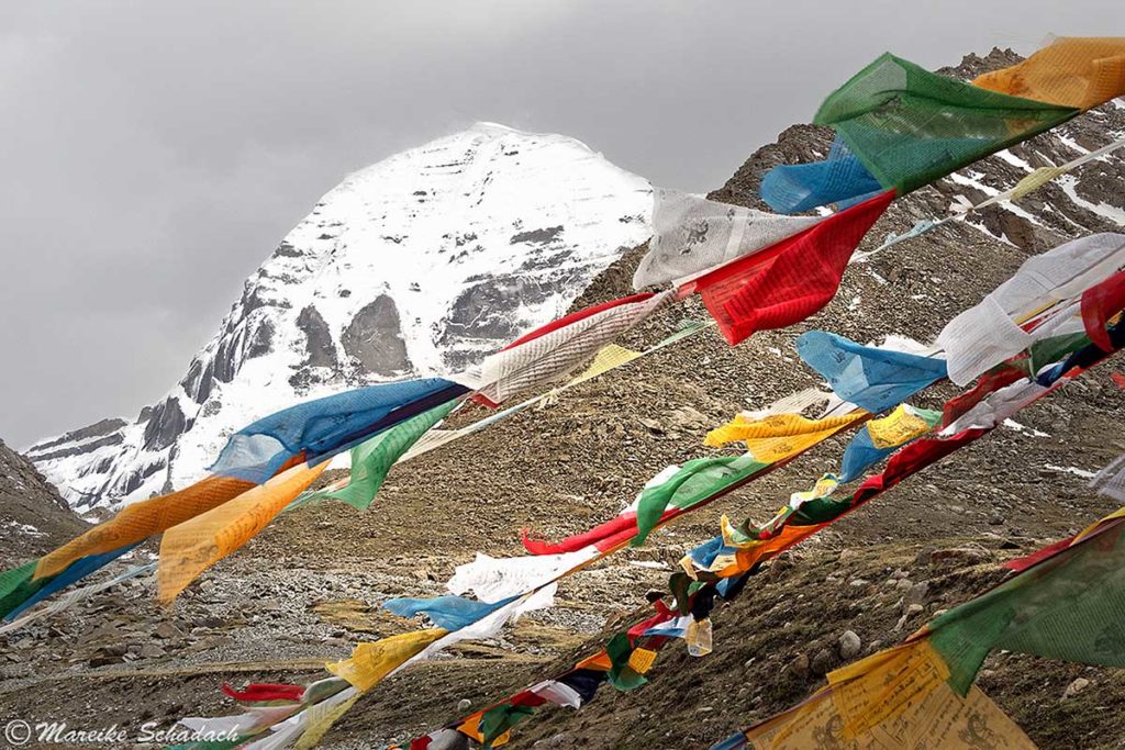
Do you love trekking as much as I do? Then you might also be interested in my articles about the circumnavigation of the holy Mount Kailash in Tibet or about 100 kilometers of hiking on the Hexenstieg in the Harz mountains.