
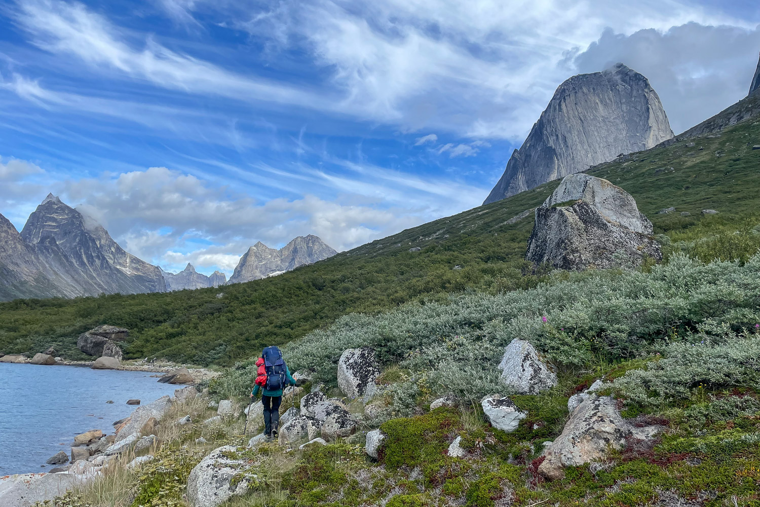
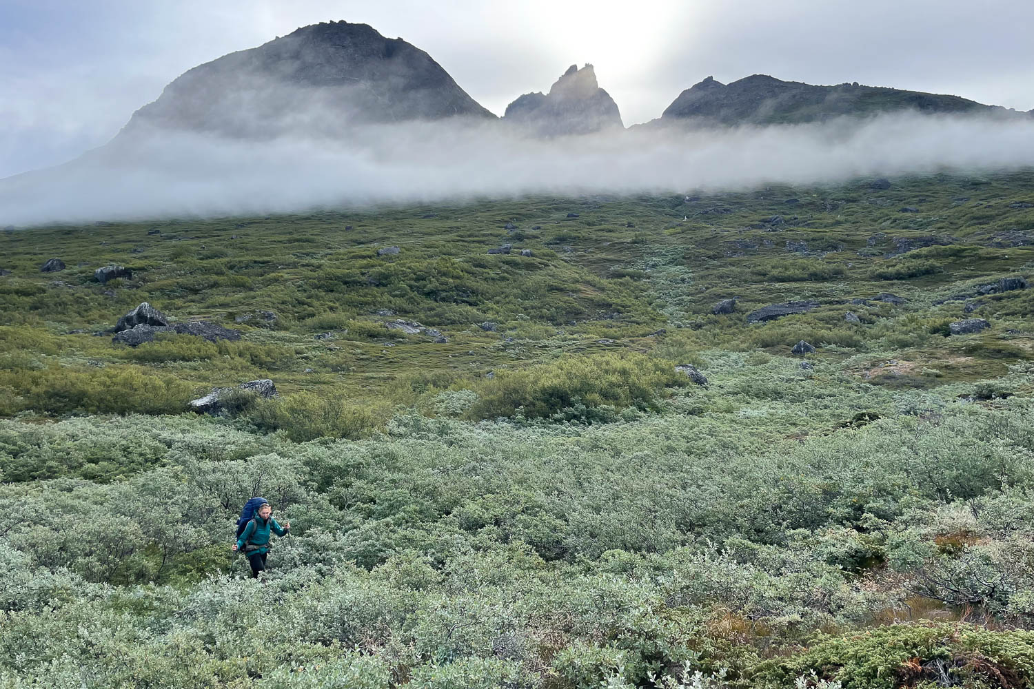
Greenland. One of my feet stuck between two roots, branches tugged at my 26 kilo backpack and small thin twigs tore at my hair. There was no back and forth, no left or right. I took a breath and tried again. How far this strech of birch thicket reached, I could not see. The birches were taller than I was. Dwarf birches they should be. Then finally a free area, swamp, a brook and a few stones. Behind it the next birch thicket was waiting for us. For hiking at Tasermiut Fjord one needs patience and good nerves. You want more? Then read on and see what made hiking here so uniquely beautiful and rewarding.
Unassigned, unpaid advertising. The article contains affiliate links.
4 kilometers in 10 hours - Welcome to Tasermiut Fjord!
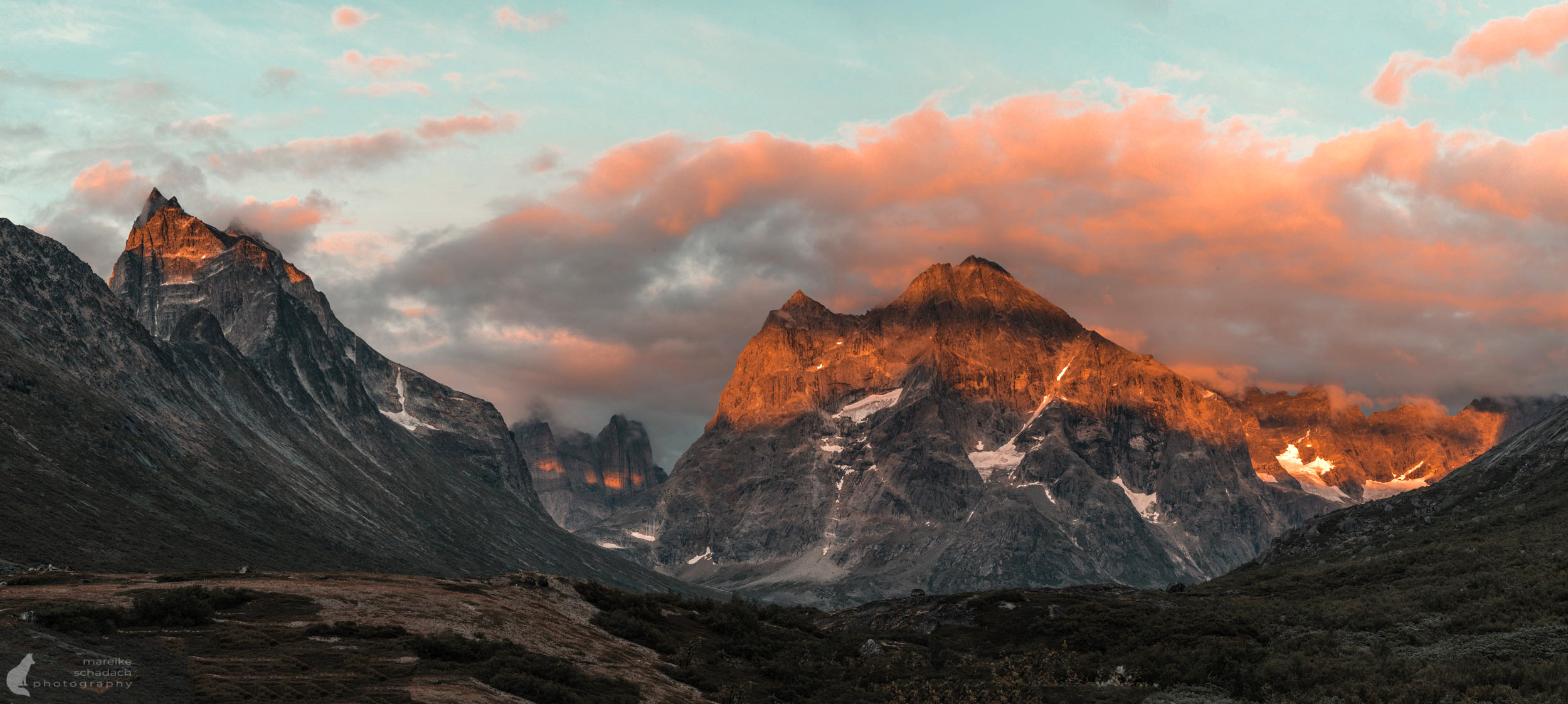
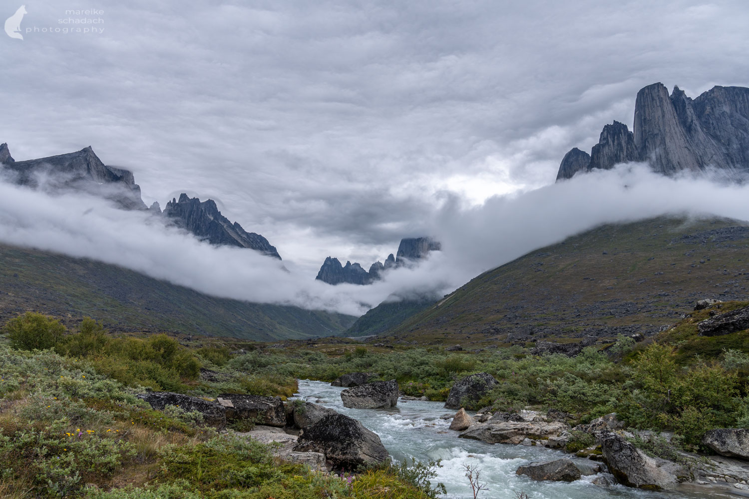
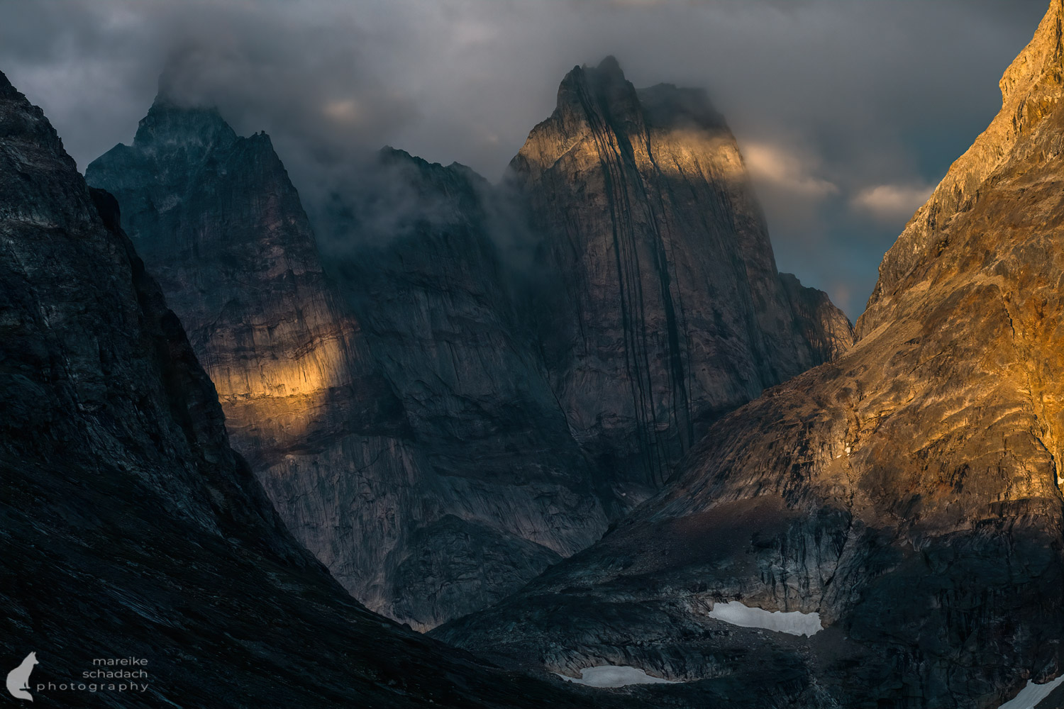
Our most important companions during our hiking tour at Tasermiut Fjord: sunglasses to protect our eyes from branches, trekking poles, my drone to scout the next trail section, chocolate and patience. Each step wanted to be carefully placed. Here, at Tasermiut Fjord, the rules of nature applied. What ideas we had about our trekking tour didn't matter in the wild. Soon we dropped our expectations, adapted and suddenly paid attention to things for which we had no eyes before. After six days on the Tasermiut Fjord, we arrived in Klosterdalen safe and sound, except for a few bruises, and just in time for sunset. The mountains in front of us shone in orange light and clouds played around the rugged peaks of Ketil and other, nameless peaks. Nothing beats a moment like this.
Tip: You prefer paddling to hiking? You can organize kayaks at the Tourist Information or at the Blue Ice Cafe in Narsarssuaq.
In the Patagonia of Greenland
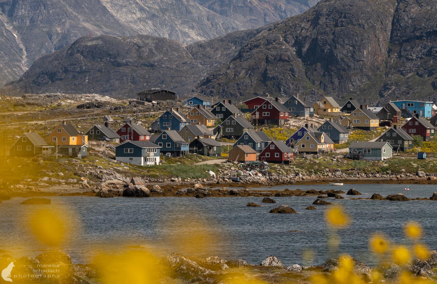
Some call the Tasermiut Fjord the "Patagonia of Greenland". Others call the area the "Yosemite of the Arctic." But no matter how one names the place, everyone agrees: these are the most beautiful mountains in all of Greenland.
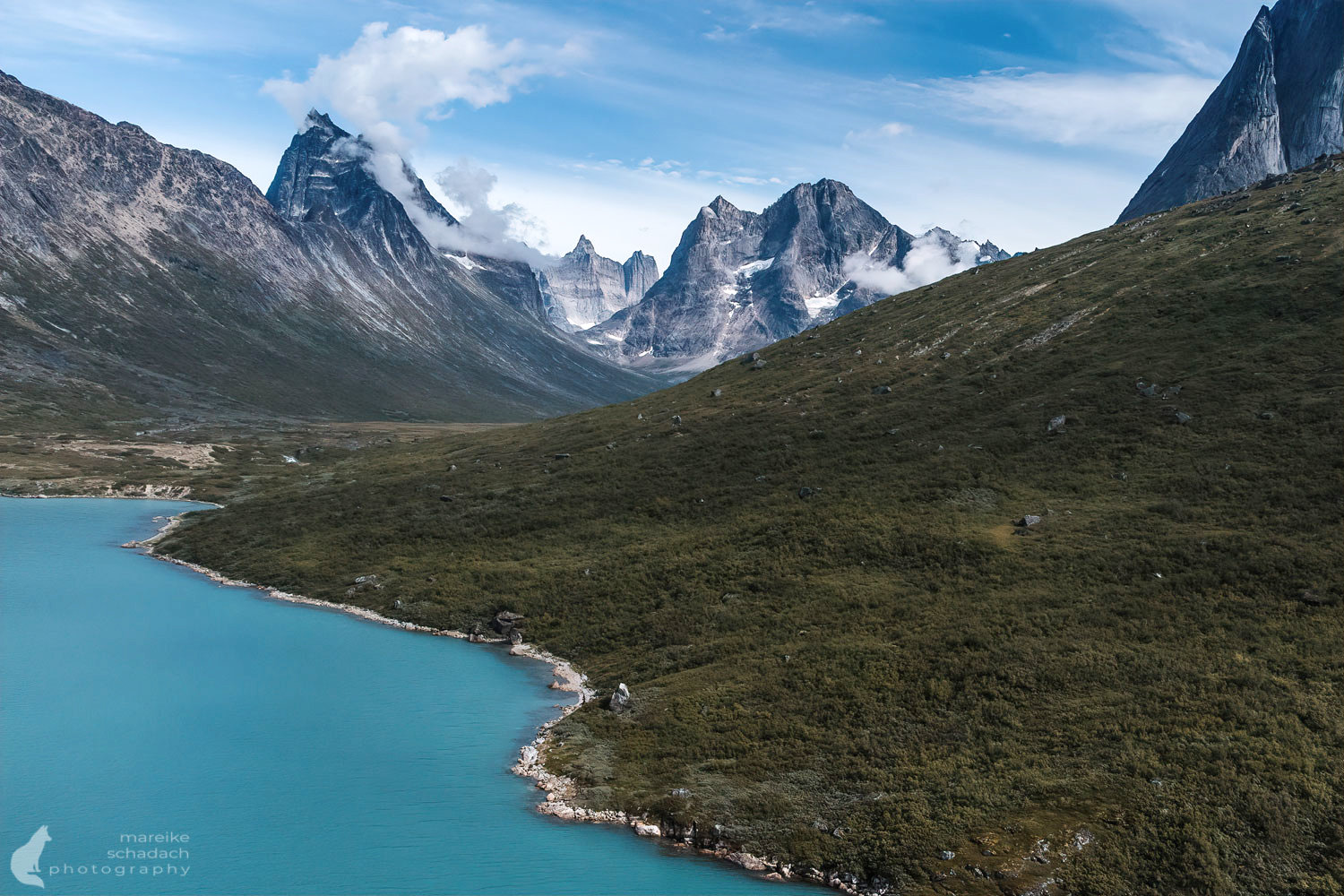
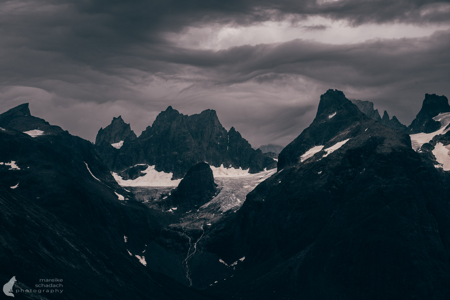
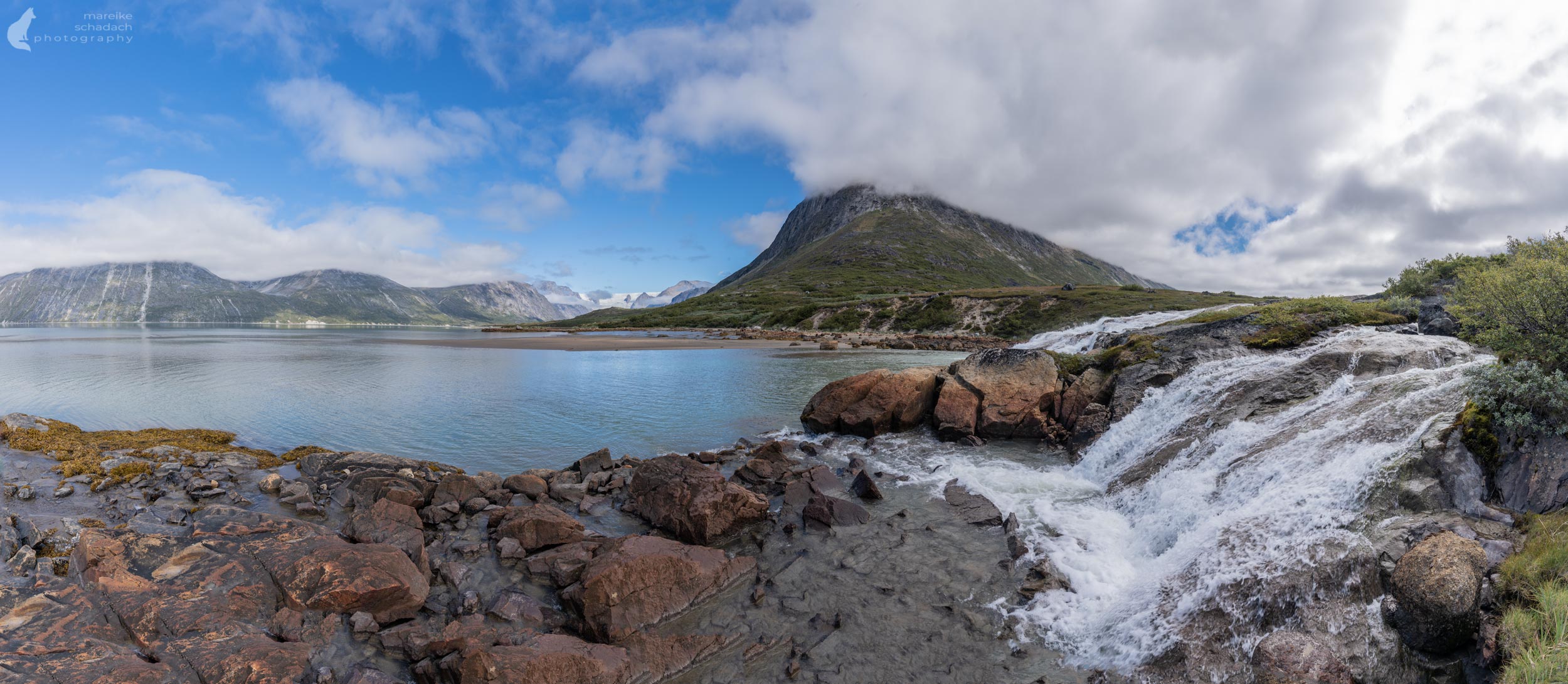
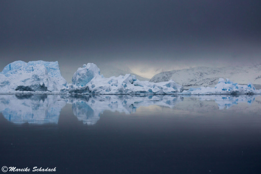
The Tasermiut Fjord in South Greenland is famous for its rugged mountains and is popular with mountaineers, hikers and kayakers alike. Besides the mountains, snowfields on the mountain flanks, glaciers, wild rivers and low-hanging clouds characterize the image of the fjord. If you go hiking here, you will experience firsthand how green Greenland is.

The " Big Walls" on the Tasermiut Fjord include Ulamertorsuaq (1,858 meters, the Arctic version of El Capitan in Yosemite), Nalumasortoq (2,054 meters, shaped like an open book) and finally the huge granite pyramid of Ketil (2,010 meters). At the end of the fjord rises another great wall: the Tasermiut glacier, 1,400 meters high and three kilometers wide.
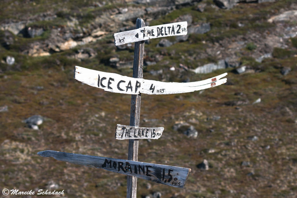
Hiking routes at the Tasermiut Fjord
There are several "recommended routes" from Tasiusaq to Klosterdalen, which are listed in the hiking map South Greenland Tasermiut fjorden - Nanortalik 1:100.000 . The routes run along the fjord shore or through the river valleys Qinnguadalen, Tupaassat and Klosterdalen. These are not hiking trails or paths. And honestly, at least on the fjord shore, the recommendation of the map is completely useless. You have to find your own way there. Maybe it is different in the river valleys. Only at the very beginning, near Tasermiut, there is a gravel road and paths or sheep trails. Otherwise it is pathless terrain: Meadows, blueberry scrub, marsh, willow bushes and dwarf birch trees. Sections lead along the shore, which is sometimes littered with larger rocks. Climbing is the order of the day. It becomes easier at low tide (tide table Nanortalik). However, in addition to the recommended routes, the hiking map gives other helpful information on its reverse side about hiking, kayaking, climbing, fishing as well as about nature and behavior in nature at Tasermiut Fjord. Worth reading and important to know!
What is missing in the map: the bridges over two glacial rivers are not shown. One is over the Kuussuaq river and the other is over the river between Ulamertorsuaq and Ketil mountains.

Hiking at Tasermiut Fjord and Klosterdalen in South Greenland
Day 1: Boat transfer and hike from Saputit to the Kuussuaq River.
Shortly after departure of our boat to Saputit we threw our plan A overboard and decided instead for the shorter hiking route along the eastern shore of Tasermiut Fjord: only about 32 kilometers instead of the big loop through the river valleys Qinnguadalen, Tupaassat and Klosterdalen with about 65 kilometers. With a shorter route we would be more flexible to the rain announced for the whole coming week and could simply wait in the tent for better weather.
For the boat transfer to the start of the Hiking Tour at the Tasermiut Fjord , it is best to contact Serano Boat Tours via Facebook Messenger. We got a transfer for the next day.

Rain, rain, rain, rain, rain, rain....
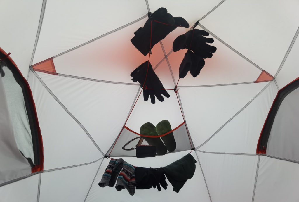
We waited for the rain in the tent sooner than we would have liked. We barely set up our tent after our first 7.5 kilometers when it started to rain. Eleven hours of heavy rain, wind and even a small thunderstorm banished us to the tent until noon the following day. The meadow was soon flooded and the raindrops pressed through both tent walls. The water also penetrated the tent floor in some places. But there's always something positive: The cooking pot that I had left in my vestibule overnight was filled to the brim with rainwater for the breakfast coffee in the morning. Fortunately, I had covered my backpack after the first shower in the vestibule to protect it from the rain. However, my boots got a little soaked at the beginning.
Thunderstorms are extremely rare in Greenland. Luckily it stayed far away, otherwise we would have had to come up with something. One is not safe in a tent during thunderstorms. More about safety when camping during thunderstorms can be found here.
Info about the Route
Length: By boat: about 32 kilometers (about 45 min); on land: about 7.5 kilometers. Alternatively, you can be dropped off in Tasiusaq. The pretty village of 25 inhabitants has a small supermarket and you can rent the cottage from Serano. Your hiking distance will be about 5 kilometers longer.
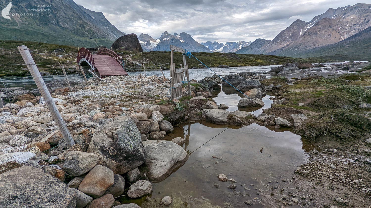
Camp 1: On the northern bank of the Kuussuaq River is a large open meadow for camping. The meadow is marked as a suitable camp in the hiking map. However, sheep have also taken a liking to the meadow, which is why it is littered with droppings. There is a garbage can and a fireplace.
Trail: Initially gravel trail, passing two sheep farms; later trail (sheep trails); several fences have to be crossed either at the right place to open or at the designated overclimbing points; a bridge leads over the Kuussuaq River, fording is not necessary (would not have been possible with the water level we found)!
Drinking water: From the river Kuussuaq next to the camp. Because of the omnipresent sheep droppings, disinfect the water if necessary, e.g. with Mikropur Forte tablets*. For us it worked without.
Day 2: Boat transfer and setup at Camp 2
When we dared to leave the tent the following day around noon, Christian was standing in front of us. He had come with two Norwegian guests for fishing. After a short chat he offered us a boat ride to the next camp. At first I said no, after all we had come here for hiking. It should still be about 15 kilometers that day. But in the end my inner pig and my wet trekking boots won out. We quickly packed up, climbed into the boat and were at the camp after a bumpy twenty minutes. During the trip, even the weather cleared up a bit. As we approached the camp, we couldn't believe our eyes: two paragliders flew down one of the mountains with their colorful parachutes.
Actually, we thought we wouldn't meet anyone during our hike. But as soon as we arrived, Luc showed up. "Do you like to join us and have a cup of tea with me and my friends? " - Sure! His friends were climbers from France and Belgium. They had been here in camp for three weeks, climbing new routes. Under their tarp next to a big rock it looked really cozy: A table, benches made of stones, a big cooking pot and lots of other useful stuff. In the corner even hung a net with collected Lapland tea to dry. In front of the camp Emma held the position, a stone woman with hair made of seaweed.
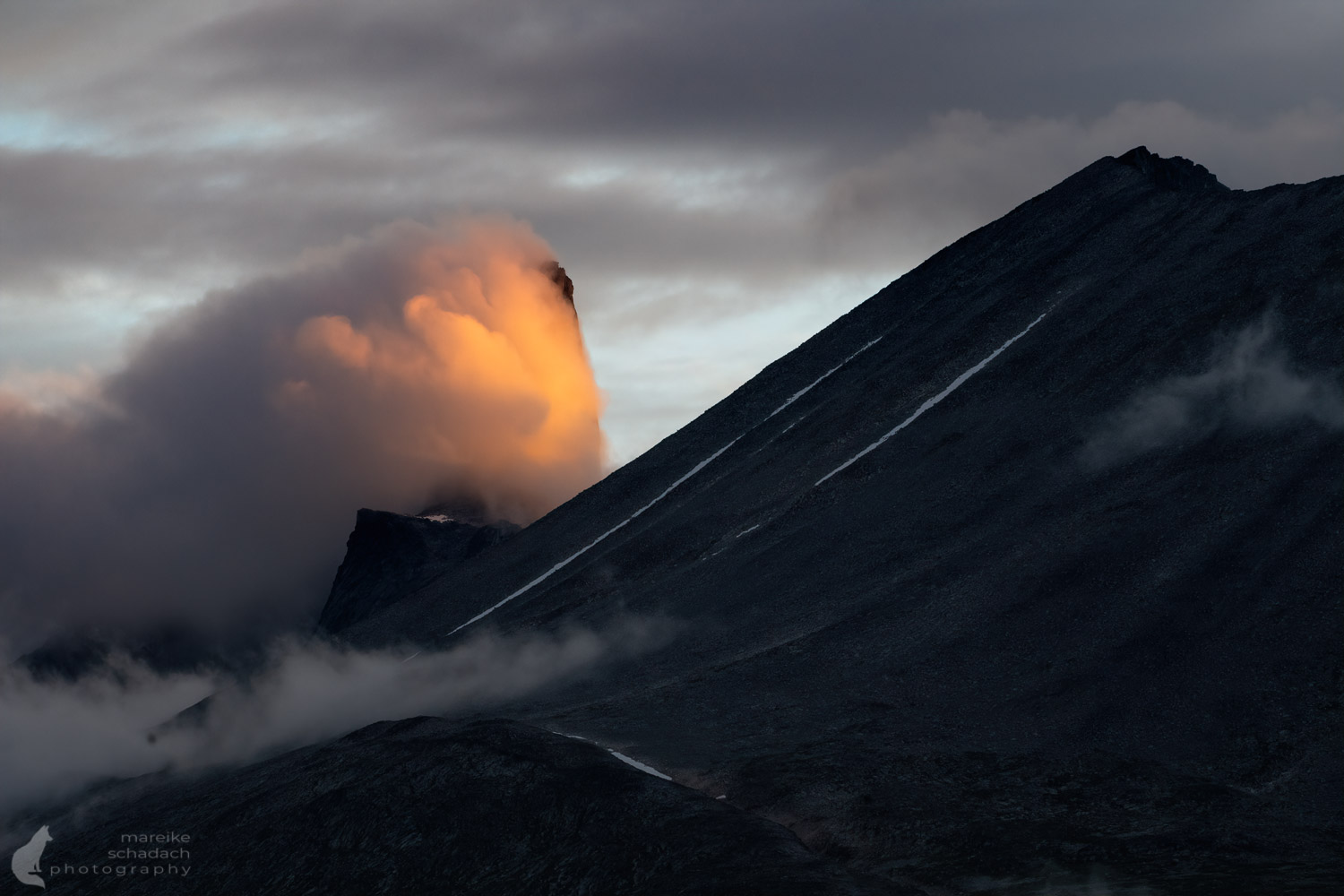
In the evening, the cloud cover broke even further and revealed the view of the mountains. The panorama was indescribably beautiful. We stood there in awe until the clouds took over the mountains again.


Info about the Route
Length: in the boat: about 17 kilometers (about 20 min)
Camp 2: On both banks of the river between the mountains Ketil and Ulamertorsuaq are open meadows for camping. These are not marked on the trail map.
Specifics: A suspension bridge spans the river. Note: In September 2025, I learned that the bridge had been destroyed.
Drinking water: from the big river next to the camp

Days 3 and 4: Short hikes from Camp 2.
We stayed at the camp for three nights. The weather did not encourage further walking and my ankle was painfully swollen in the evening. It must have happened during the bumpy boat ride. I didn't twist my ankle and an overload from sitting in the tent and expecting the rain stopping was also unlikely... Instead of hiking further towards Klosterdalen, we did two shorter hikes in the area with light packs.
The first hike took us at first over the suspension bridge and then parallel to the shore towards the south. There was a trail that was easy to walk. We followed this to the next glacial river and then a bit inland on sheep trails.

On the way we kept looking for musk oxen. But as we learned afterwards, they should only be found on the western shore of the Tasermiut Fjord. Instead we enjoyed smaller companions: curious birds that came closer and often accompanied us for a while. As soon as we sat down and took a break they squatted on the neighboring rocks and didn't seem to be shy of us at all.
The next day we followed the path upstream from our camp until it got lost in the dense brush. Since the brush was still wet from the rain, my boots quickly got wet again. While walking through, I scraped the water from the plant parts, which then ran down my legs to my shoes.

Day 5: Here we go: departure towards Klosterdalen
We planned our departure for the following day, according to the weather forecast of our Garmin inReach Mini 2*the sun should shine. Then we would still have two and a half days time, until Serano picks us up with the boat in Klosterdalen. The eight-kilometer distance we should easily manage. And when we are in Klosterdalen, we could do some small explorations there. At least that's what we thought... it turned out differently.

We were quickly proven wrong: For the 8 kilometers we needed no less than two days with one seven and one 10 hours of hiking (including breaks). Swamps, shrubs, willow bushes and huge dwarf birches made every meter a small fight. But everything started quite relaxed. In sunshine and a light breeze, the first few hundred meters were along a path and then along the shore. Then the rocks got bigger and the shore steeper, so we had to swerve uphill. At first we thought the dense bushes were only there in some patches and could be easily bypassed. But eventually it became more and more dense and there was no other option but to go across. Around four o'clock in the afternoon we had enough. Next to a small stream we set up camp and unpacked the whiskey bottle as a reward.

A few words about safety: be aware that you can break your ankle at any moment while hiking through the birch thicket. Tightly laced trekking boots category BC are indispensable. Train your balance with a heavy backpack on your back: squats on one leg, lunges, etc. Have your first aid kit handy so that you can quickly apply a (pressure) bandage if necessary. Practice this beforehand! Allow enough time to sit out any rain in the tent and not have to rush in the difficult terrain. It is not a good idea to run under time pressure. And so that you can still enjoy the great scenery in Klosterdalen at the end: wear sunglasses and protect your eyes from stinging branches. Und damit ihr am Ende noch was von der tollen Landschaft in Klosterdalen habt: tragt eine Sonnenbrille und schützt eure Augen vor stechenden Zweigen.

Info about the Route
Length: approx. 7 kilometers
Walking time incl. breaks: approx. 7 hours
Camp 3: on the way, next to a small stream
Trail: pathless terrain: initially banks, then marsh, shrubs, willow bushes and dwarf birch trees
Specifics: There are smaller mountain streams to cross, which is mostly possible with stepping stones, a jump or just walking through. Only one stream we had to ford, but this was very easy.
Drinking water: on the way from numerous mountain streams

Day 6: Through the wilderness to Klosterdalen
The further we got towards Klosterdalen, the denser the wilderness became. I had read in blog articles about Klosterdalen that it goes in places only with 1 km/h. But that it will be here on the fjord shore a good 70% of the way so, I had not thought. (In retrospect, however, it is clear that it will be so, because after all you stay on the coast at the same altitude with similar conditions). The "recommended route" marked on the trail map was not apparent. Worried about missing a trail or open terrain, I sent my drone into the air. We then used the photos to pick the best route. Mostly it was from rock to rock, because there the vegetation was not quite so dense. From time to time we could walk on the shore, or climb over rocks. Only the last kilometer along the shore let us relax a bit.


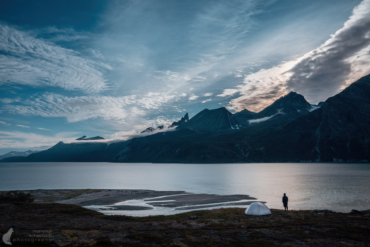
At sunset we were standing at the camp in Klosterdalen. The last rays of the sun colored Ketil and Co. in warm orange. What a great reward for what was probably the most difficult hike I've done so far.
In the afternoon the wind increased more and more. In the evening it was so stormy at our camp that I took extra care to peg down our tent. But even with wind, the view of the mountains was simply fantastic. We put on another layer of clothing and enjoyed the view. Shortly after the sun disappeared behind the mountains, the wind also died down. But with the calm came the mosquitoes.

The mosquitoes of Klosterdalen
Some of the midges became part of our dinner: mashed potatoes with soaked dried vegetables. There were the small mosquitoes, similar to midges in Scotland, and also larger mosquitoes. Klosterdalen had significantly more than the other camps. But for me it was still ok without a mosquito net over my head. Most mosquitoes hung around my partner, who then also pulled a net over his head. From the mosquito spray Deet, which we used, the mosquitoes were rather unimpressed. It is best to check in Nanortalik, that you get a regional mosquito spray, which is adapted to the mosquitoes here.
Info about the Route
Length: 4 kilometers
Walking time incl. breaks: 10 hours
Camp 4: Klosterdalen, south of the river. The camp is marked on the trail map.
Trail: Pathless terrain: swamp, shrubs, willow bushes and dwarf birch trees. At the end shore with rocks.
Specifics: The further you hike into the fjord, the denser the vegetation becomes. No significant stream crossings.
Drinking water: on the way from numerous mountain streams; from the river Uiluii Kuua next to the camp.
Day 7: Boat transfer Klosterdalen - Tasiusaq - Nanortalik
The next day our boat came two hours earlier than planned - "We expect strong wind in the afternoon and we could not sail then - so we came earlier" said the captain. Thirty minutes later we were in the boat, the water was smooth as glass and the monastery ruins of Klosterdalen we will probably see another time.
How did Serano know we were already at the meeting place? I had given him the Internet address of my Garmin inReach. The tracking function recorded our location every half hour so he could trace our route on the map.
By the way, here, in the remote valley, there was an Augustinian monastery in the 10th century - hence the name Klosterdalen. Today there are only a few ruins left, but they are said to be barely recognizable. Unfortunately, we were not able to look for them due to time constraints.

Stopover in Tasiusaq
To Nanortalik it is about 70 kilometers by boat, about 1.5 hours drive. The closer we came to the mouth of the fjord, the higher the waves and the stronger the wind. White foam crowns stretched over the breaking waves and water splashed into our little nutshell. Greenland showed us again with ease how small and vulnerable we are. How easily one of the bigger waves combined with a gust of wind could have knocked over our little boat. We turned away and let ourselves drift with the wind back to the small town of Tasiusaq.

Later in the afternoon, the wind was supposed to weaken again. One just had to wait a bit. The blue wooden house of Serano invited us to stay with a warm stove and coffee (you can also rent the house). In the small supermarket of the village of 25 inhabitants we also get everything for a delicious lunch (card payment possible).
Around five o'clock in the afternoon we finally set off and were soon back in Nanortalik. After our hiking tour at the Tasermiut Fjord we were looking forward to a warm shower. On the way to the hotel we stopped briefly at the supermarket and bought a few treats for the evening.
Sad story: All inhabitants of the village Tasiusaq starved to death about 140 years ago. Only in the 1930s the village was repopulated by descendants and family members of the original inhabitants.

Some additional info at the end
- Buy the hiking map South Greenland Tasermiut fjorden - Nanortalik 1:100.000 and read the information on the back.
- A lot more information can be found in "The Ultimate Greenland Hiking Guide" from visitgreenland.gl
- Plan one or two buffer days for your hike and take extra food with you. The boat cannot come to pick you up in all weather conditions.
- There is no cell phone reception. Take either a satellite phone or, for example, a Garmin inReach and familiarize yourself with its operation beforehand.
- You are in polar bear country. Check with the tourist information office and your boat guide for any sightings and reschedule if necessary. More info on what to do during polar bear encounters.
- “Leave no Trace!” - better read again...


How to get to Tasermiut Fjord?
Tasermiut Fjort in South Greenland is relatively easy to reach, at least for Greenlandic conditions. You can fly from Reykjavik to Narsarsuaq. From there you have the choice: either in the expensive helicopter of Air Greenland to Nanortalik or by boat. Since we were already halfway there (Narsaq), we continued our journey by boat.
You can book the boat trip at Discoline . The trip is often done with the boats from the Blue Ice Cafe. Blue Ice Cafe.
From Nanortalik you need a charter boat that takes you to Tasermiut Fjord. We asked for help at the tourist information office. There we got the contact to Serano Boat Tours and could arrange a transfer for the next day. The cost of the transfer there and back was 700 euros (as of 2022).
Book Recommendations for Greenland
You want to know where the journey goes? Then I can recommend these books*.
You can order the books with a click on the pictures on Amazon. If you buy a product via an affiliate link, I get a small commission, and you help me to keep filling Fernweh-Motive with interesting articles. The product will not be more expensive for you, and you will do me a huge favor.


Equipment
Below you can see the equipment we took with us to our hiking tour at Tasermiut Fjord. Most of it worked well. Only my Goretex boots were no longer waterproof after four years of frequent use (for whatever reason). I also wished our tent would have let less rain through. 1500 mm water column for the outer tent and 1800 mm for the floor were a bit low. But in return the tent was light and stood reliably even in strong winds.
Camping
- Slingfin Crossbow 2 Four Season Tent
- Thermarest Neoair Matress*
- Mammut synthetic fiber sleeping bag
- Seat Pad
Kitchen
- Primus ESSENTIAL TRAIL STOVE DUO - Gas Stove
- Trangia Alu Topf, Deckel, Griff
- 4 Nalgene bottles*
- Sea to Summit cutlery*
- Coffee mug Titan by Snow Peak*
- Victorinox pocket knife*
- Waterproof matches*
- Magnesium fire starter*
- Garbage bags
- Vitamin tablets
- Freeze-dried trekking food
- Bread, cheese, jam, peanut butter
- Various snacks, chocolate, nuts, homemade pemmican
Navigation and Security
- Garmin GPSMAP 64xs*
- Compass
- Hiking map
- Garmin inReach Mini 2*
- RAB Emergency Bivouac for two persons
- First aid kit
Camera equipment
- Sony Alpha IV*
- Sony FE 24-70 mm f/2.8 GM*
- Sony FE 100-400mm f/4.5-5.6*
- DJI Mavic Mini 2 Fly More Combo*
- Handy Pixel 6 Pro
- Powerbank
Garments
- Rain jacket
- Rain pants
- Softshell pants
- Hiking Leggins
- Fleece sweater
- Down Jacket
- Merino Longsleeve
- 2 Merino T-Shirts
- 2 pairs of merino socks
- Trekking boots category BC
- Camp and wading shoes Keen
- Gaiters
- Buff
- Waterproof gloves SealSkinz
- Cap
Hygiene
- Mini towel
- Ecological soap would have been quite good, but we forgot about it
- Sunscreen
- Moskitospray Deet
- Mosquito net
- Toilet paper
What else?
- Gregory backpack 75 liters
- Leatherman Rebar*
- Duct tape*
- Leki Sherpa trekking poles*
- Sunglasses
- Waterproof packsacks
- Petzel Actic Core Headlamp*
- Repair kit with spare buckles, sewing kit, screws, cable ties etc.
Have you ever been to Greenland? Maybe even for a hiking tour at the Tasermiut Fjord? How did you like it? Do you have any questions about my article? If yes, please write me a comment!
Do you want to know when there are new articles on my blog? Then follow me on Facebook, Pinterest or Instagram. I would also be very happy if you share my article with your friends.
Recommendations for further Reading
Want to know more about travelling in Greenland? Then click here for my article about my Hike to the Ice Cap at Eqi Glacier or about my Winter Trip to East Greenland.


Hallo Mareike,
ein außergewöhnlicher und gelungener Reisebericht.
Beim Lesen bekommt man eine Gänsehaut. Ich konnte eure Strapazen regelrecht spüren. Die Bilder stimmungsvoll, brillant = alles rundum gelungen.
Berührt hat mich die Formulierung: „… nach den Regeln der Natur …“ Ich glaube und das ist meine Meinung, wir sollten alle Staatsoberhäupter dieser Welt nach Grönland schicken (Ohne Komfort!!). Eine Maßnahme, um zu begreifen, dass man in erster Linie die Naturgesetze respektieren muss. Ich hoffe, dass viele Menschen Deine Berichte lesen, begreifen und handeln!
Regine
Liebe Gine,
danke für Deine schönen Worte!
Ja, es ist nach wie vor so, dass die Natur uns einiges beibringen kann/könnte, wenn man sie denn ernst nimmt.
Alles Liebe
Mareike
Hallo Mareike,
da ich die Gegend auch schon unter den Füßen hatte möchte ich (auch zur Vermeidung von Fehleinschätzungen und Misserfolgen durch Nachahmer) ein paar Punkte anmerken.
In den Flusstälern Qinnguadalen und Tupaassat ist die Karte nicht hilfreicher oder weniger hilfreich als am Fjord. Sie teilt halt mit das es irgendwie ohne Bergsteigen geht, wie genau muss man selbst rausfinden. Allerdings ist das Gelände dort noch um einiges anspruchsvoller. Mehr und dichteres Gebüsch, größere Sümpfe, in den höheren Lagen sehr blockig und dazwischen Zonen mit halbhohem Gebüsch auf großen Blockfeldern, so dicht das man nicht richtig sieht wo man hintritt – ganz übles Knochenbrechergelände. Dazu zwei schwere Bachquerungen (der Bach im Klosterdalen ist im Vergleich harmlos, da zwar tief aber fester Grund und langsam fließend). Die Bachquerungen lassen sich vermutlich vermeiden, allerdings tauscht man dann die wenigen halbwegs gängigen Kilometer auch noch gegen schwer aussehendes Gelände.
Ich habe für die Strecke von Tasiussaq zu den Klosterruinen (wirklich nicht sehenswert, der Platz an sich ist halt sehr schön) sechs Tage gebraucht (zur Einordnung: für die Strecke welche du als zwei Wandertage a 7 und 10 Stunden beschreibst habe ich in Gegenrichtung etwa 6 Stunden benötigt). Wer durch die Täler läuft hat es an den Ruinen mehr oder weniger geschafft, der Weg am Fjord nach Tasiussaq ist dann Formsache.
In letzter Zeit kommt es immer häufiger vor das in der Gegend auch im Sommer noch einige Eisbären unterwegs sind. Da es schwierig ist einfach woanders hinzufahren sollte man sich vorher überlegen ob und wie man damit umgehen kann. Z.b. Warnzaun für Nachts mitbringen (gibt es vor Ort nicht, falls doch nicht benötigt kann man ihn in Nanortalik oder Tasiussaq lassen), vor Ort Waffe leihen oder kaufen und vorher den Umgang damit erlernen. Überlegen welchen Schlafsack man wie nutzen möchte (wer drei Minuten braucht um im Halbschlaf den Reißverschluss zu finden hat auch mit Warnzaun schlechte Karten).
Die Einheimischen am Fischmarkt in Nanortalik und im Supermarkt in Tasiussaq organisieren die Transfers auch. Man muss halt ein paar Stunden Wartezeit einkalkulieren bis jemand Zeit hat. Kostet dafür weniger als halb so viel. Ob man sich darauf verlässt bei dieser Variante auch wie vereinbart an den Ruinen abgeholt zu werden muss jeder selbst wissen. Persönlich würde ich mich für nur die Strecke am Fjord immer reinfahren lassen und rauslaufen. Aus Tasiussaq kommt man sicher irgendwie weg.
Viele Grüße
Holger
Hallo Holger,
vielen Dank für deine umfangreichen Ergänzung, die noch viele weitere hilfreiche Hinweise enthält. Es ist wahrlich kein einfaches Gelände. Ich freu mich für dich, dass du die große Runde ganz geschafft hast.
Viele Grüße, grad aus Schweden
Mareike