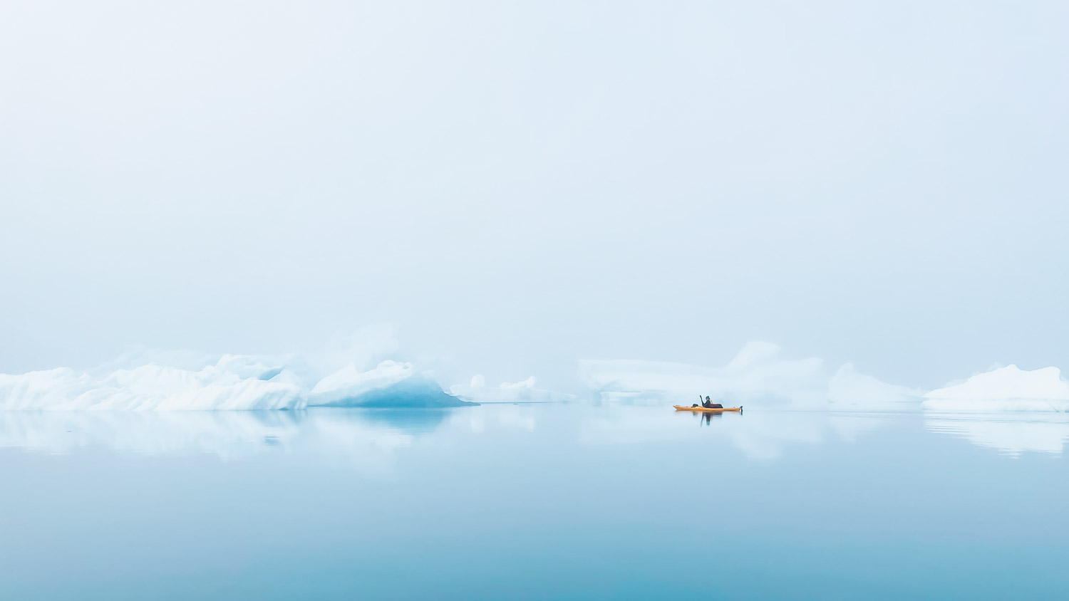
Eisberge, Gletscherfronten, Vogelklippen und zwei gelbe Kajaks: Sieben Tage lang paddeln mein Partner und ich 150 Kilometer von Narsaq bis zum Qaleraliq Gletscher, wo die endlose Weite von Grönlands Inlandeis beginnt. Unsere Kajaktour in den Eisfjorden im Südwesten von Grönland war schon vor dem Start ein Vollzeit-Job: Recherche, Planung, Vorbereitung und schließlich das Packen ließen die To-Do-Liste vor der Tour immer länger werden. Doch die Ruhe in den Fjorden, das leise Plätschern beim Eintauchen der Paddel, die Eisberge und deren Spiegelungen im Wasser ließen uns all die langen Abende vorm Computer und den Karten schnell vergessen.
You can find a similar version of the following article in Kajak-Magazin 01/2024..
Unassigned, unpaid advertising. The article contains affiliate links.

Greenland is cold, windy and a polar bear lurks behind every second iceberg. So it's no wonder that the centerpiece of our tour planning was a multi-page safety plan. The "What do we do if..." scenarios ranged from an encounter with a polar bear, capsizing, and various injuries to the loss of equipment or even a kayak. We were prepared for everything. That's what we thought.
What we hadn't expected was the glassy sea in the mornings and plenty of sunshine. We were sweating in our dry suits and preferred to put on a bit more sunscreen instead of a hat and gloves. Nor did we expect to be offered fresh seal liver by a seal catcher or to be woken up one morning by the roar of a helicopter.

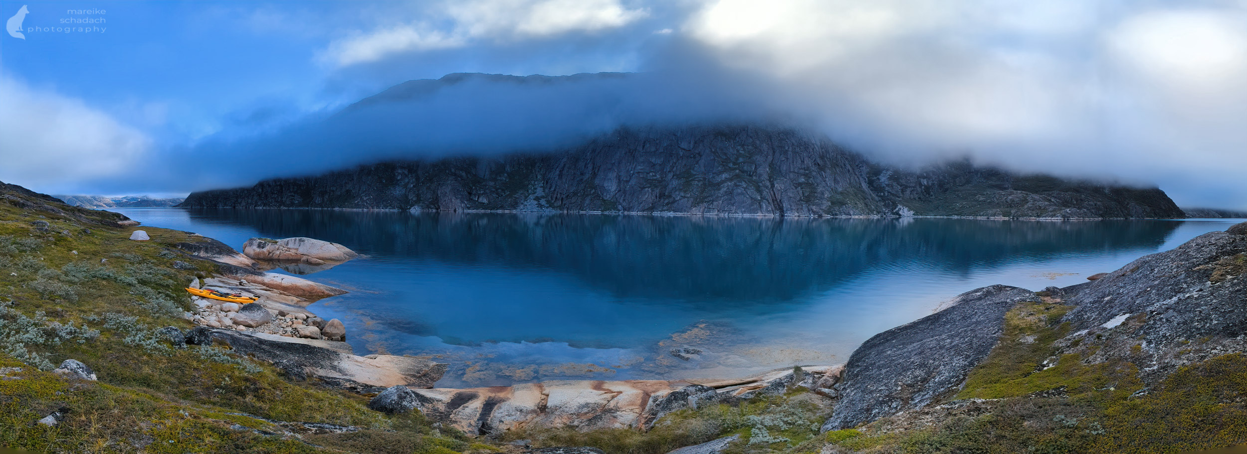
Paddling Paradise between steep Cliffs, Icebergs and Glacier Fronts
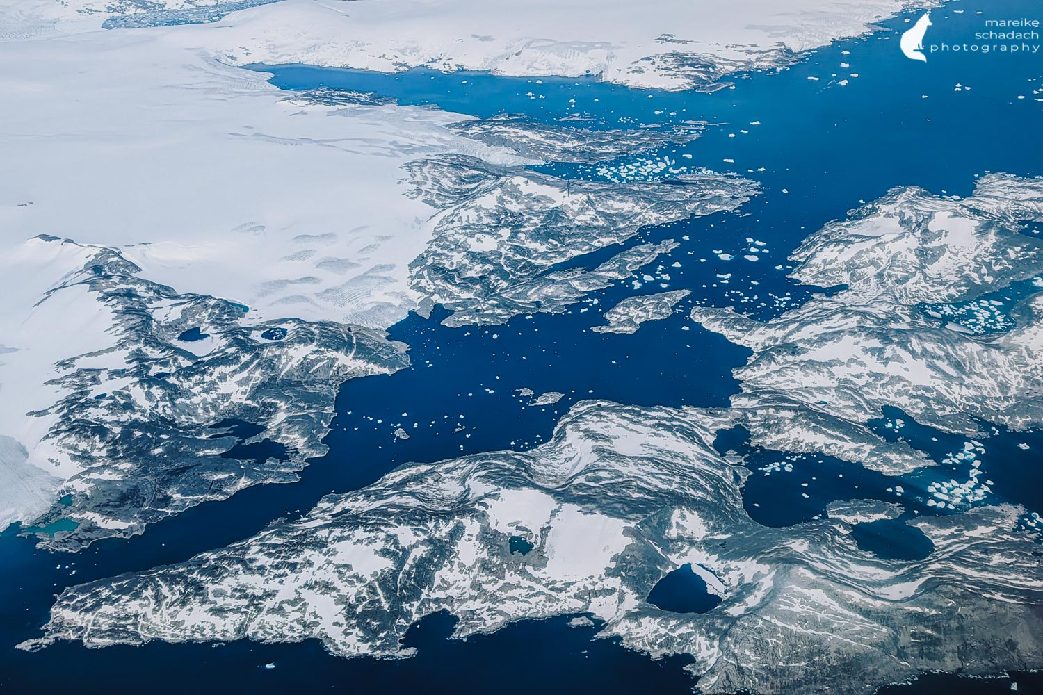
The starting point of our kayak tour is the town of Narsaq in the southwest of Greenland. With just under 1,400 inhabitants, Narsaq is the second-largest town in the municipality of Kujalleq. The fjords here are particularly beautiful for paddling, as there are more icebergs here than anywhere else. Most of the ice comes from the Eqaloruutsit glacier, around 60 kilometers away, and drifts west towards the open sea. The branching fjords, steep banks, and many islands make this a beautiful and relatively sheltered paddling area for experienced paddlers and outdoor enthusiasts.

All Beginnings are difficult... and so was Day One of our Kayak Tour in Greenland
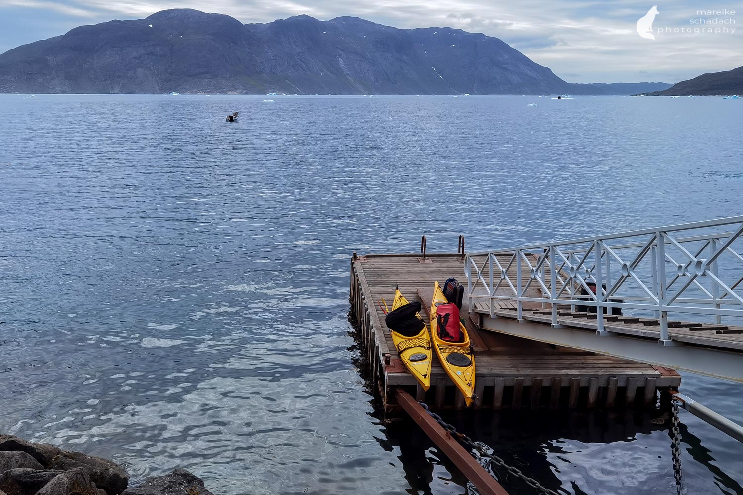
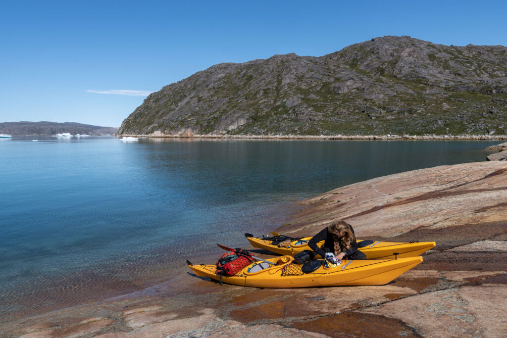
We hired the kayaks, life jackets, dry suits, distress signals, and the satphone from Blue Ice Explorer in Narsarsuaq . We continue by water cab to Narsaq, about 50 kilometers away. But as the saying goes? All beginnings are hard... In our case, it is deep: from the landing platform, we lower the fully loaded kayaks about one meter into the water. Then we climb in after them. There is no beach or shallow jetty within easy reach.
Only in the second bay after that is a small beach, a sports boat jetty, and a supermarket where we buy the rest of our provisions. After what feels like an eternity, all our luggage is finally stowed in the kayaks. Before we set off, we take a break and treat ourselves to a coffee and one of those delicious pastries in the supermarket. Then we finally set off. At that moment, we wouldn't have believed that we'd be back here in the supermarket the next day, drinking another coffee and eating another Danish pastry.


What happened?
Spaghetti or Spirelli...or not...
In the evening at camp, I'm faced with the difficult choice of spaghetti with pesto or spirelli with tomato sauce for dinner. I opt for spaghetti and look forward to the hot meal. I quickly unpack the cooking utensils and want to screw the stove onto the gas cartridge. Irritated, I look at the cartridge and try again. But it doesn't help. The stove doesn't fit on the cartridge, and redundancy doesn't help if you have the same stove attachment and the same gas cartridge with you twice. Not all screw threads are the same. Even if the difference is only a fraction of a millimeter and invisible to the eye. The kitchen remains cold that evening. The next morning we paddle back to Narsaq and pray to all the old and new gods that we can get suitable gas cartridges from the supermarket. We are lucky. To be on the safe side this time, I try out both cartridges with both stoves. After all, it's not just our hot meals that depend on the stove working, but also our drinking water. We melt it from the glacier ice floating on the water. This is pure fresh water. It is so pure that we even add extra electrolyte powder.


Across the Bredefjord with new Gas Cartridges
The return to the supermarket extended our paddle tour by 18 kilometers. We have already used up our bad weather buffer day on the second day of our tour. I'm frustrated and fear that we won't reach our destination, the Qaleraliq glacier, at all. At the end of July, it is still light for a long time here in South Greenland. However, paddling times are often limited due to the tidal current and stronger winds in the afternoon.
But when we arrive back at our camp from the previous night in the afternoon, the paddling conditions are so good that we immediately attempt the four-kilometer crossing of the Bredefjord. The weather is also kind to us on the following days, so that we make much faster progress than expected.
Wind and Weather
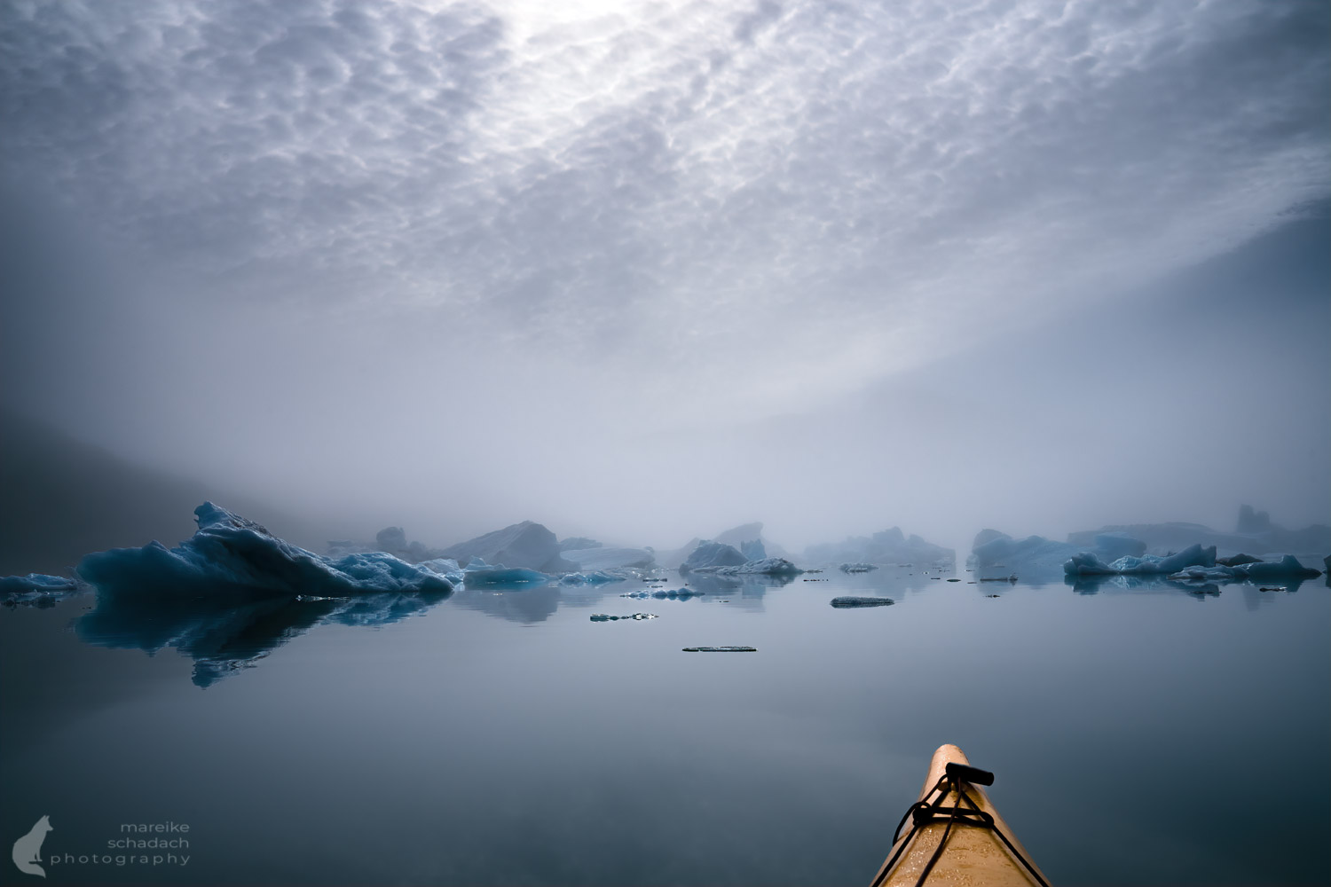
We get the weather forecast from our GPS tracker. The weather is always better than forecast. However, due to the high mountains, the branching fjords, and the strong sunlight, the conditions in each fjord change over the course of the day. In the morning, the water is often as smooth as glass. The sun then causes local balancing winds to set in around midday, which become stronger and stronger during the afternoon and subside again in the evening.
I check the barometer three times a day and observe the clouds in the sky throughout the day. Every day, cirrus clouds form, which usually indicate a change in the weather within the next two days. But the air pressure remains constantly high. The weather only changes when we are back in Narsaq and in dry accommodation. What luck!
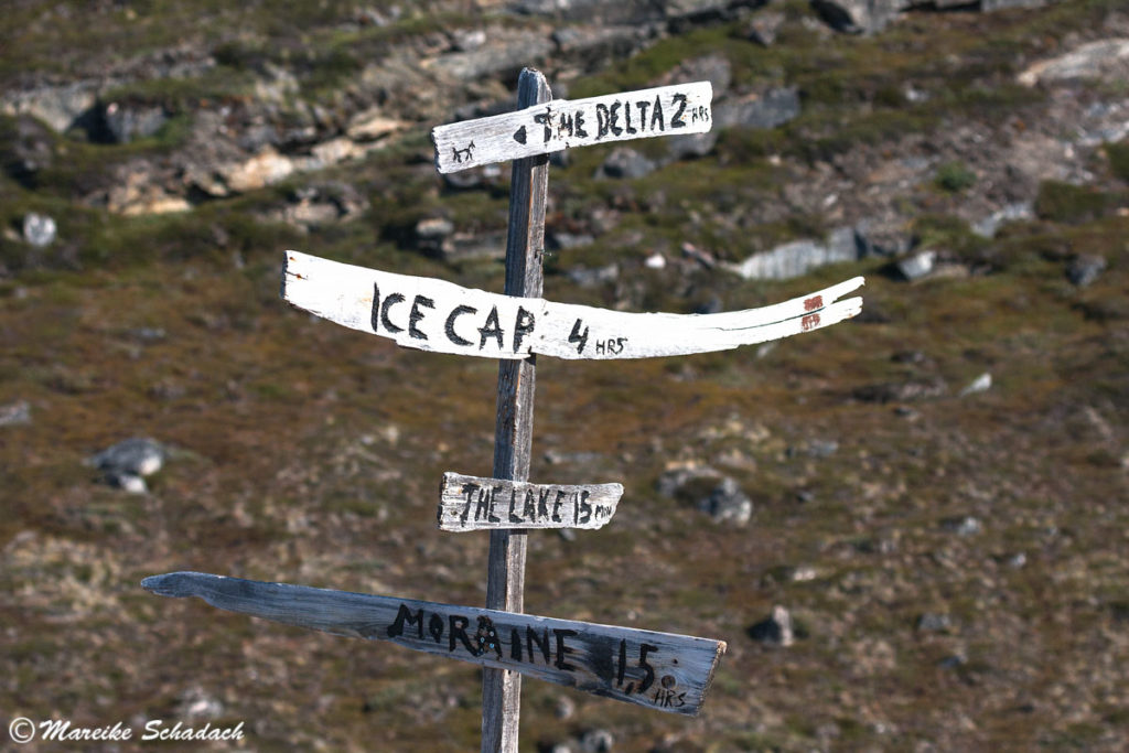
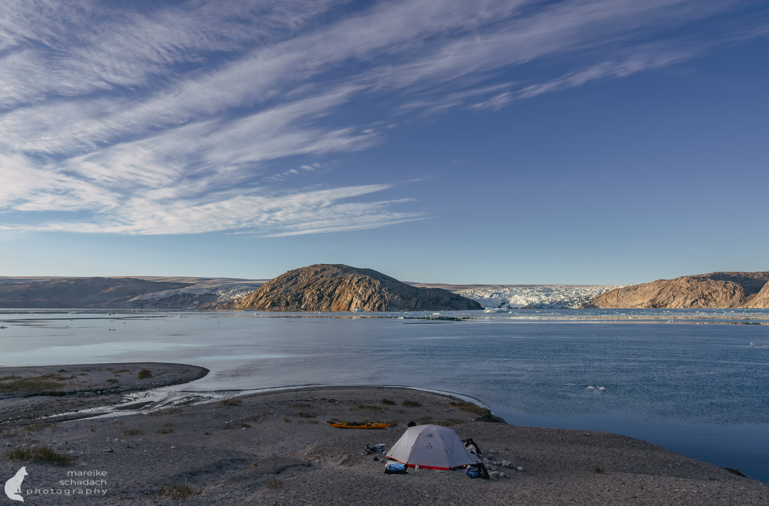
Qaleraliq Glacier - the Destination of our Greenland Kayak Tour
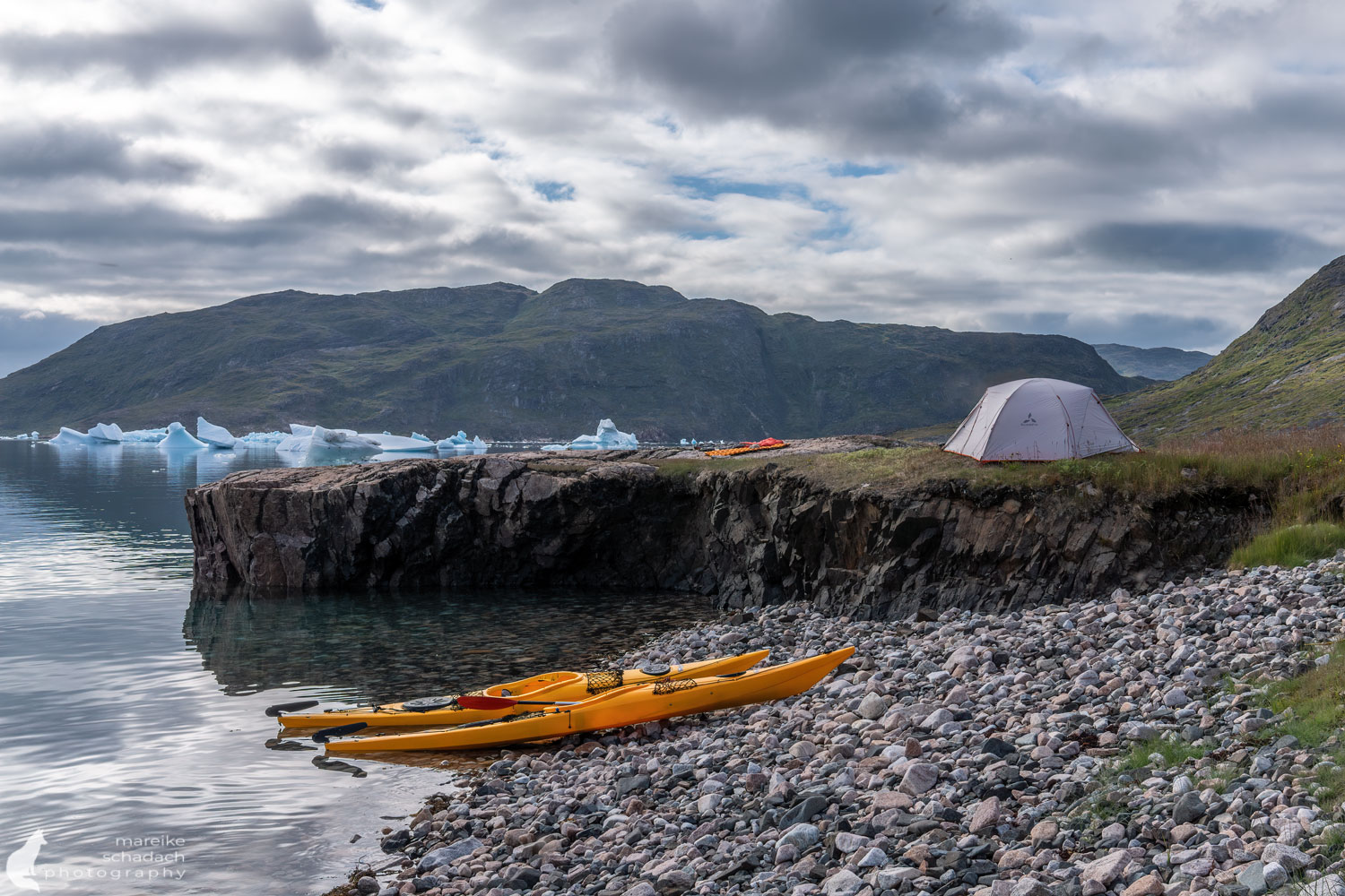
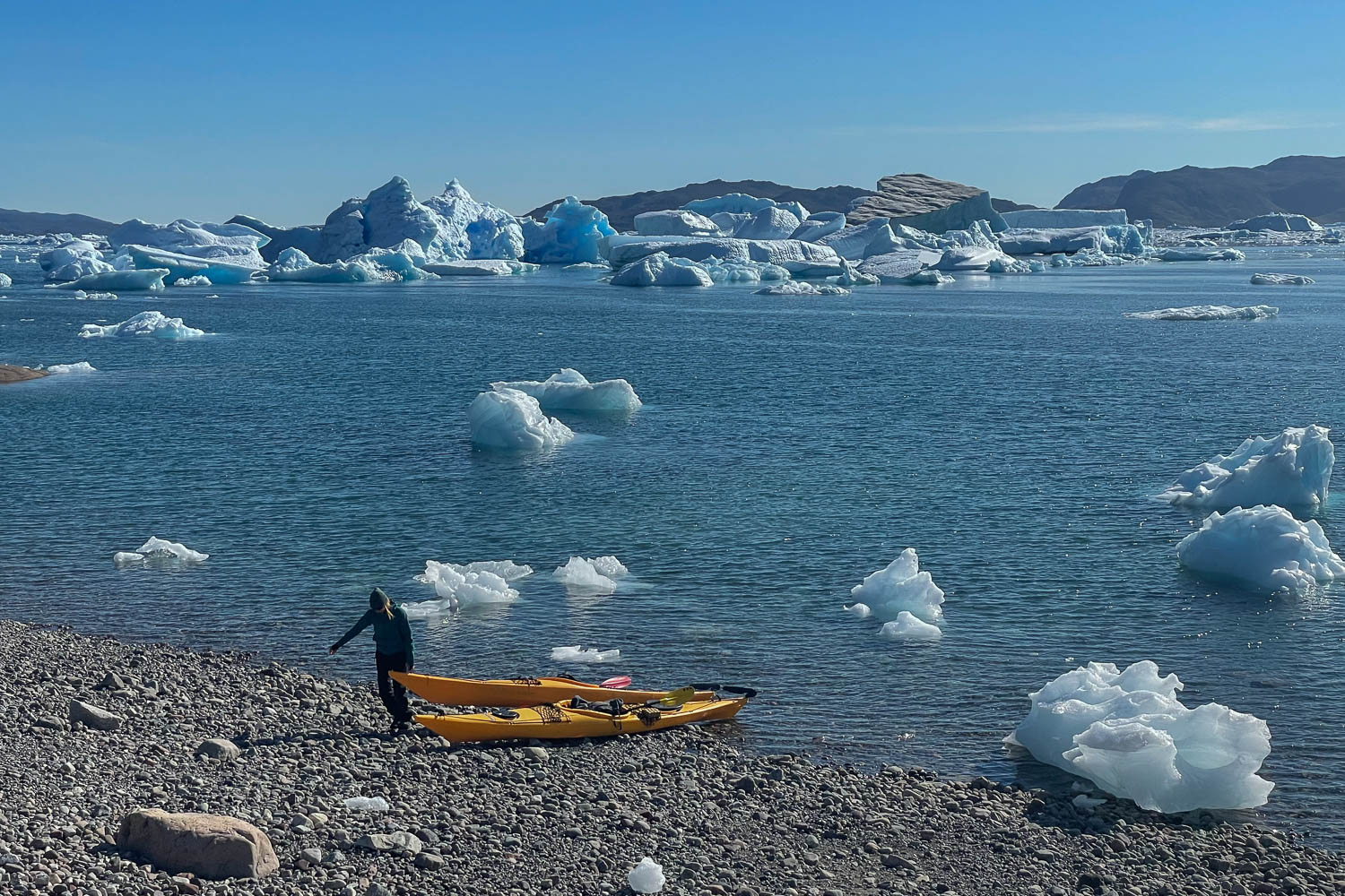
After four days of paddling, we finally reach our destination and turning point, the Qaleraliq Glacier. South-north expeditions to the Greenlandic ice sheet used to start from here. Today, Qaleraliq Camp offers Arctic comfort with a view of the remains of the glacier front. Due to global warming, the glacier has retreated considerably, splitting into three smaller glacier tongues. Only two of them still calve icebergs into the water. Due to the coronavirus pandemic, the camp is closed in the summer of 2022 and we pitch our tent on a neighboring hill.
The next morning, I listen contentedly to the calls of the seabirds. But suddenly a loud engine roars in my ears. A cruise ship has anchored in front of our camp and started flying its guests over the Qaleraliq Glacier by helicopter. It's time to get up. I'm amazed at how quickly we break camp this time and load our kayaks.

Tip: Little treasures* that make paddler's life easier:Tip: Small treasures* that make life easier for paddlers:


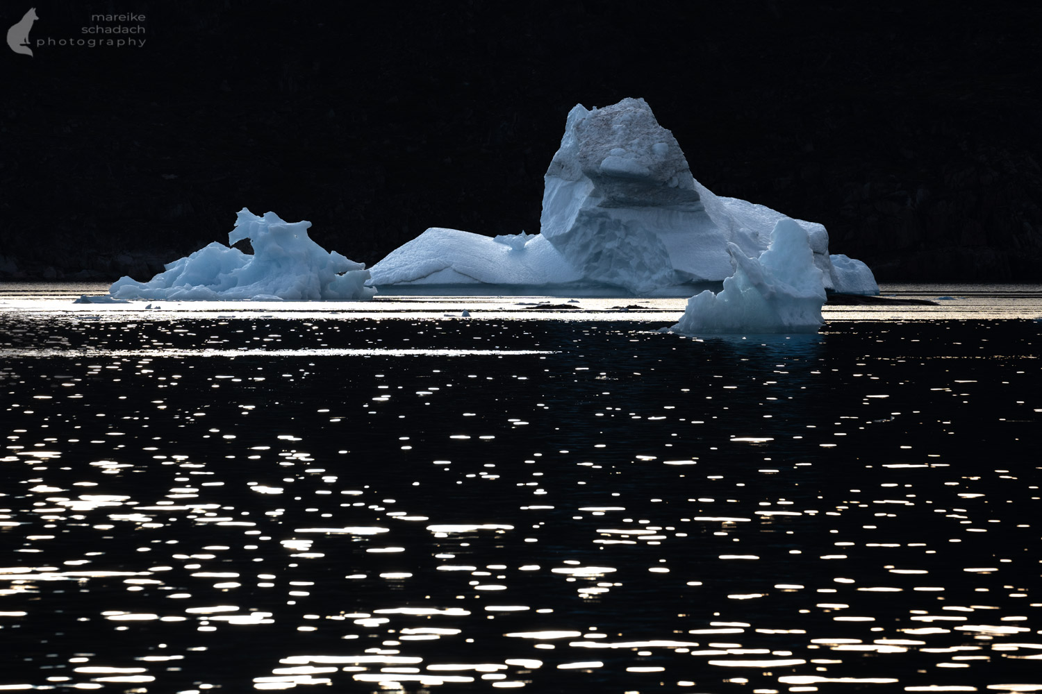
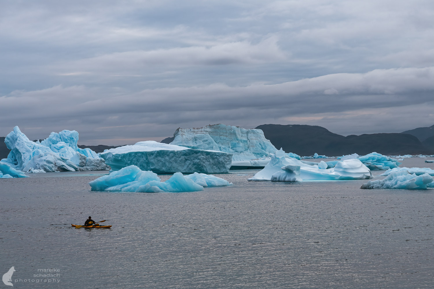
Keep your Distance - Icebergs break, roll or collapse in on themselves
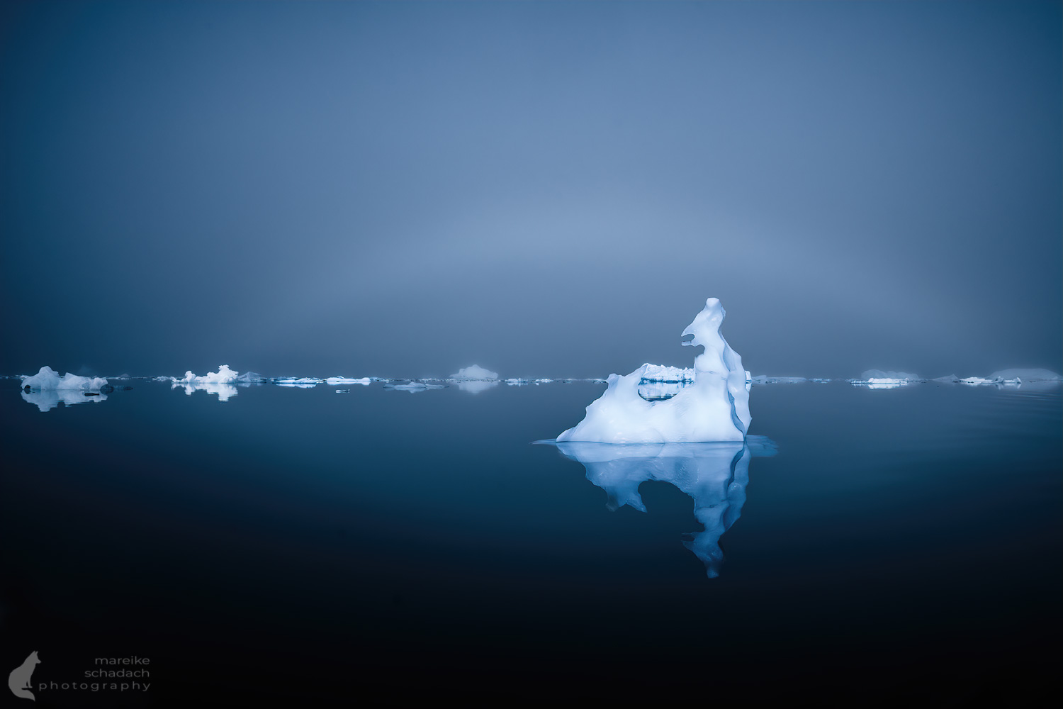
We keep our distance from the glacier with our kayaks. We also prefer not to get too close to the large, towering, or otherwise unstable-looking icebergs. Especially in the afternoon, after the sun has warmed the ice, we hear pieces of ice breaking off again and again and see icebergs rolling and sometimes making considerable waves. Even on land, you have to expect waves from out of the blue at any time. That's why we never let the boats out of our sight during breaks and prefer to tie them up once more than once too little.


Route Planning with Satellite Images
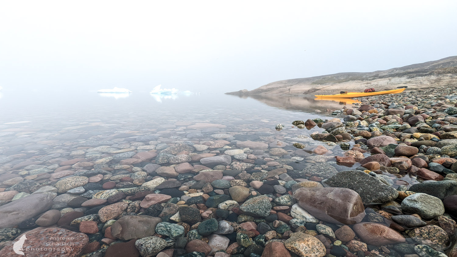
The banks of the fjords are wild, usually steep and often unsuitable for landing with a kayak. In addition to the risk of getting our feet wet from icebergs tipping over in the tent, we also have to take into account a tidal range of around three meters. Although there is a rough map of the area, the nature of the shoreline and its suitability for entry and exit are not recognizable. Instead, I analyzed satellite images to plan my route and used Google Earth to create my own map for our kayak tour in Greenland. I marked possible places to land or camp in color. I planned our daily sections with lengths of 20 to 25 kilometers, knowing full well that the weather could quickly throw a spanner in the works. The only thing we couldn't use was a planned camp at the foot of a mountain, as the risk of falling rocks was too high. It was going to be a long day of paddling. We had to paddle several kilometers to the next suitable spot. What's more, we had previously taken too long a break and now had to paddle against the tidal current in choppy water. We were cursing!


A nocturnal Visitor to say Goodbye
We spent our last night at the same spot where we set up camp for the first time.
I sit outside for a long time, not wanting the day to end. Something dark flits across the stones next to me. At first, I thought it was one of the many ravens, but it doesn't fly away. The animal remains like a mere shadow in the not-quite-dark night. Slowly, I recognize a small head watching me. Then I see the elongated body and the bushy tail. I carefully turn around to get a better look at the little Arctic fox. We look at each other for a moment, then he runs off.
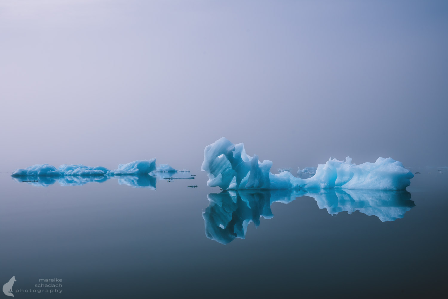
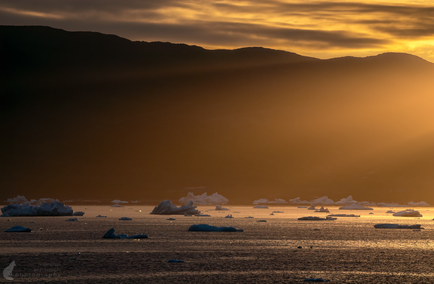
I wait a moment to see if the little fox might appear again. Meanwhile, my gaze wanders over the Bredefjord. The icebergs are at their largest directly in front of our camp. In my mind, I can see two yellow kayaks gliding between the countless icebergs. I walk back to the tent with a smile on my face.
Book Recommendations for Greenland
You want to know where the journey goes? Then I can recommend these books*.
You can order the books with a click on the pictures on Amazon. If you buy a product via an affiliate link, I get a small commission, and you help me to keep filling Fernweh-Motive with interesting articles. The product will not be more expensive for you, and you will do me a huge favor.


Have you ever been to Greenland yourself, maybe even for a kayak tour? How did you like it? Do you have any questions about my article? If so, please write me a comment!
Do you want to know when there are new articles on my blog? Then follow me on Facebook, Pinterest or Instagram. I would also be very happy if you share my article with your friends.
Recommendations for further Reading
Want to know more about travelling in Greenland? Then click here for my article about my Hike at Tasermiut Fjord or about my Winter Trip to East Greenland.