The Berlin Wall Trail runs for 160 kilometers along the former border between the GDR and West Berlin. It combines historically interesting places, natural sections within the city, and attractive landscapes in the outlying districts. Remains of the Wall and even watchtowers can still be seen in several places. Memorial stones commemorate successful and failed escape attempts, and information boards provide information about the history of the divided Germany and reunification. The Berlin Wall Trail is ideal for a multi-day hike or bicycle tour. You only want to see the highlights or individual sections of the Berlin Wall Trail? Then read on...
Unassigned, unpaid advertising. The article contains affiliate links.
All 15 Highlights of the Berlin Wall Trail at a Glance
#1 Remains of the Berlin Wall - Watchtowers and Wall
#2 The Cherry Blossom - When and Where?
#3 Former Border Crossing Bornholmer Straße and Platz des 9. November 1989
#4 Bernauer Strasse with Documentation and Visitor Centre Berlin Wall Memorial
#5 Border and Ghost Stations in divided Berlin
#6 Brandenburg Gate - Symbol for the Division of Germany
#7 Checkpoint Charly
#8 East Side Gallery - the longest open Air Gallery in the World
#9 Check Point for Vessels and Molecule Man
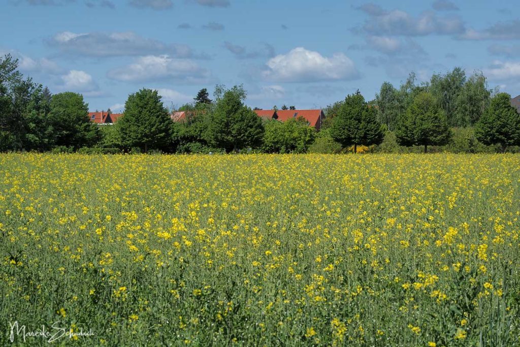
#10 The southern Route of the Mauerweg: wide Fields and Birch Groves
#11 Around the Border Checkpoint Dreilinden
#12 Section Griebnitzsee to Wannsee
#13 Glienicke Bridge aka "Unit Bridge" or "Agent Bridge"
#14 Sacrower Heilandskirche
#15 With the Ferry from Wannsee to Kladow

By loading the map, you accept Google's privacy policy.
Learn more
Why walk the Wall Trail?
The Berlin Wall Trail runs for 160 kilometers once around West Berlin. I walked it in the spring of 2020. It was my compensation during the Corona restrictions, a time when all borders in the EU and beyond were suddenly closed. Our freedom to travel, which we had taken for granted, had suddenly moved into the distant future for an indefinite period. GDR jokes were dug out and turned into corona jokes. It was - and still is - a time that made me think. Which taught me that nothing should be taken for granted. What could be more appropriate than walking the Berlin Wall Trail in this context? How must people in East Berlin have felt back then, when a wall was being built before their eyes? When their normality suddenly changed? I know that the comparison is a bit vague - but nevertheless I have seen the meaning of borders with different eyes.
But working through history is not the only reason for starting the Wall Walk. The path is simply the only long-distance hiking trail in or around Berlin and offers great opportunities for some exercise in the countryside (depending on the section) and in the fresh air. And the Berlin Wall Trail also has some really exciting highlights to offer.
The Stages of the Berlin Wall Trail
The Berlin Wall Trail is divided into 14 stages for hikers. These are between 5 and 21 kilometres long. The start and end points are each easily accessible by S-Bahn or U-Bahn. The sections within the city are somewhat shorter. Numerous information boards, sightseeings and museums, let one progress only slowly.
- Hermsdorf to Wollankstraße – 15 km
- Wollankstraße to Nordbahnhof – 5 km
- Nordbahnhof to Potsdamer Platz – 7 km
- Potsdamer Platz to Warschauer Straße – 7 km
- Warschauer Straße to Schöneweide – 13 km
- Schöneweide to Schönefeld – 6 km
- Schönefeld to Lichtenrade – 16 km
- Lichtenrade to Lichterfelde Süd – 12 km
- Lichterfelde Süd to Griebnitzsee – 15 km
- Griebnitzsee to Wannsee – 12 km
- Wannsee to Staaken – 21 km
- Staaken to Hennigsdorf – 20 km
- Hennigsdorf to Hohen Neuendorf – 10 km
- Hohen Neuendorf to Hermsdorf – 6 km
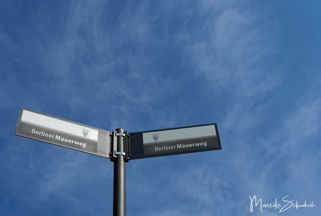
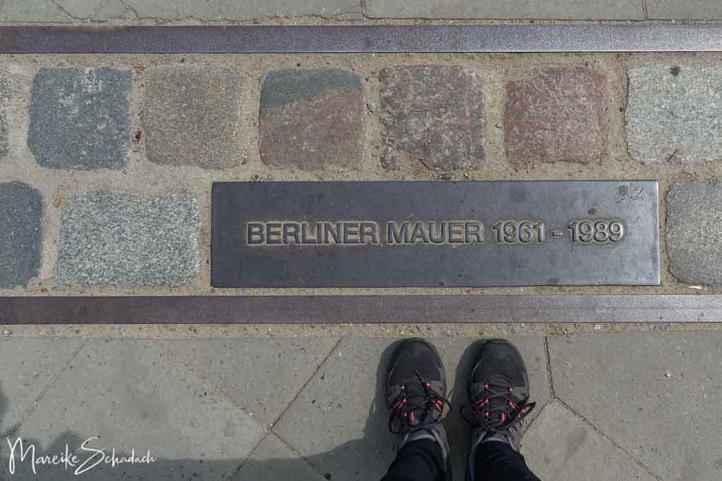
The route is well signposted throughout and can be walked without a map or GPS. In the inner city area, the course of the Wall is also marked by a double row of cobblestones. However, a map is helpful if you are looking for the nearest bus stop. A map and gpx file can be found here.
Of course you can also cycle the Wall Trail and combine stages. Bicycles can be taken along on the trains with an extra ticket.
Hiking or rather by Bike?
Many people know the Berlin Wall Trail only as the"Mauerradweg". And indeed: almost the entire length of the path is ideal for cycling. In summer, maybe even a bit too good - it gets crowded quickly and as a hiker you have the feeling that you are a bit out of place. What helps then?
- In general it is better to start early in the morning. zu starten.
- If the Wall Trail is too crowded for you, then look out for parallel hiking trails. There are, for example, between Rudow and Lichterfelde Süd.
- From Schöneweide to Schönefeld, the Wall Trail runs for 6 kilometres between the noisy motorway and the Teltow Canal without offering anything interesting. You can easily skip this section, for example by taking bus lines 160 and 265 from the James-Franck-Straße stop to Baumschulenstraße.
- There are so many things worth seeing on the stages in the city centre that the best way to get around is on foot.
The 15 Highlights of the Berlin Wall Trail
The Berlin Wall Trail is varied and there is a lot to discover. Both the history enthusiast and the nature lover will get their money's worth. I've put together a few highlights of the Berlin Wall Trail that I particularly liked.
But one more thing in advance: along the way there are many information steles that tell of escape attempts and individual fates. I read through every single story and was deeply touched. Take your time for the stories!
#1 Remains of the Berlin Wall - Watchtowers and Wall
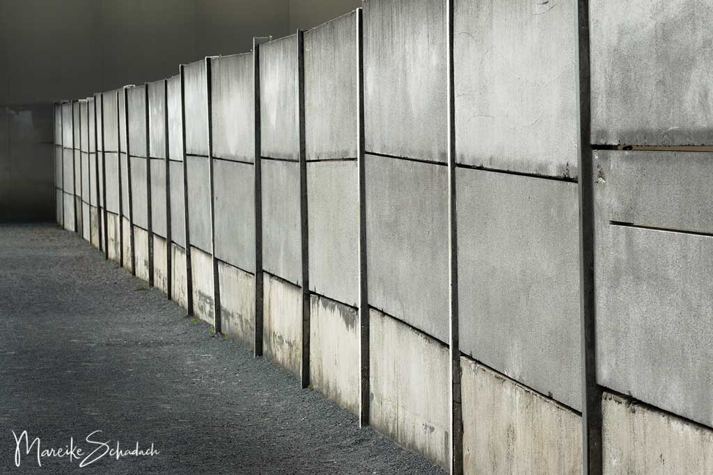
What makes the Berlin Wall Trail so special? Certainly all the remains of the border fortifications that you can still discover along the way. Especially the former watchtowers and longer sections of the Berlin Wall, but also metal fences, vehicle barriers, and the so-called Stalin lawn. Every single relict of the border installations contributes to a deeper understanding of the history of the division of Germany. And because this topic is so important, I have written a separate article about the remains of the Berlin Wall - Watchtowers and Remains of the Wall that are worth seeing.
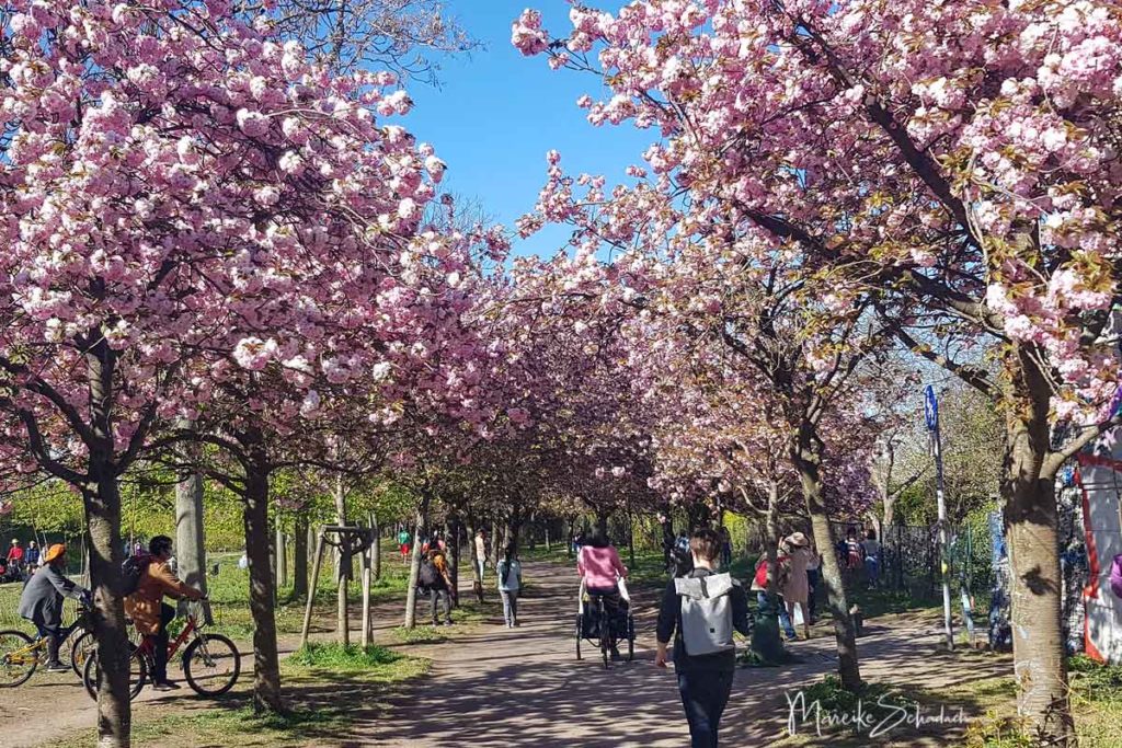
#2 The Cherry Blossom - When and Where?
The cherry trees blossom in April, the exact start depends on the weather. Berlin's longest cherry tree avenue with over 1000 trees is located on the Berlin Wall Trail between Ostpreußendamm and Japan-Eck (Lichterfelder Allee 165). The Hanami cherry blossom festival is celebrated here every year. But there are also sections with cherry tree avenues in the city, for example next to the Wollankstraße S-Bahn station and on the section directly in front of the Bornholmer Straße S-Bahn station. The trees are a gift from Japan to celebrate the first anniversary of the fall of the Wall.
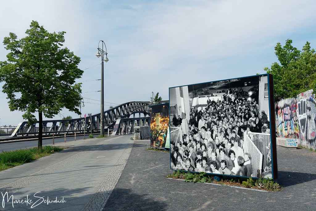
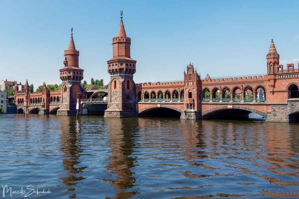
#3 Former Border Crossing Bornholmer Straße and Platz des 9. November 1989
The border crossing on Bornholmer Strasse was the first of the seven Berlin crossings to be opened on 9 November. The barrier went up at about 22.30 hours. Crowds streamed across the Bösebrücke bridge into West Berlin. A timeline on the ground and an open air exhibition with photographs and texts document the events. Here you can really join in the excitement of what happened after Politburo member Günter Schabowski announced at the legendary press conference that Western travel was possible across all border crossings. From now on! Here you can still see a piece of the hinterland wall of the border fortifications.
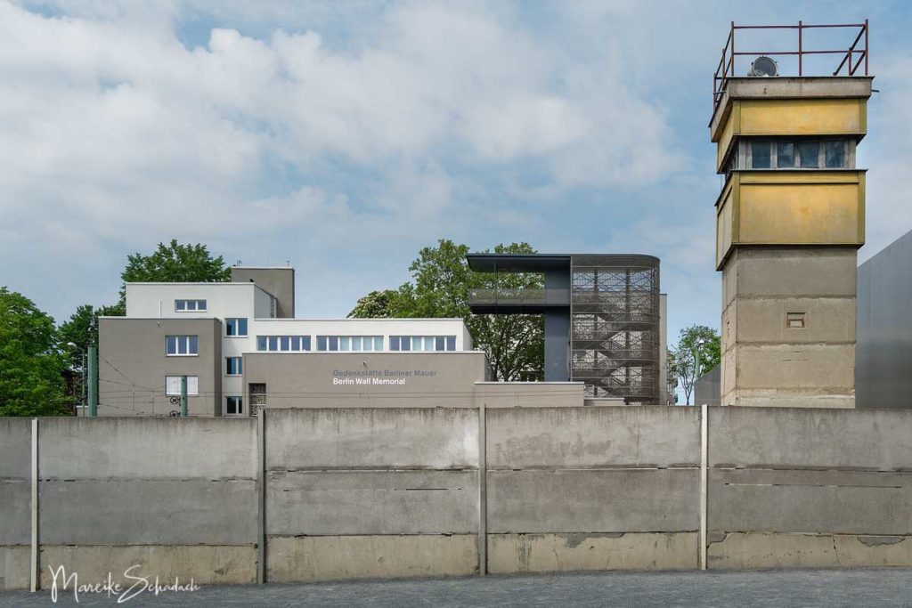
#4 Bernauer Strasse with Documentation and Visitor Centre Berlin Wall Memorial
The 1.4 kilometer long Berlin Wall Memorial begins opposite Mauerpark. You'll have to plan a little more time here. Numerous information pillars document the events on Bernauer Strasse with photos and touching texts. This is where particularly dramatic escapes occurred in August 1961. Because the houses on Bernauer Strasse were in the east, but the pavement in front of the houses belonged to the French sector. When the border guards here began to wall up the windows of the ground floor apartments in August 1961, many of the residents tried to flee from the upper windows. Not everyone was lucky. Finally, the houses were cleared and demolished in 1965.
Several escape tunnels were also dug in Bernauer Strasse. Their location is indicated on the ground by markings.
At the end of Bernauer Strasse it is worth visiting the Documentation Center and the Berlin Wall Memorial Visitor Center. From the observation tower of the Documentation Center you can see a section of the Wall in its original structure , including the watchtower. This is the only complete section of the Wall that is still standing. Admission is free.
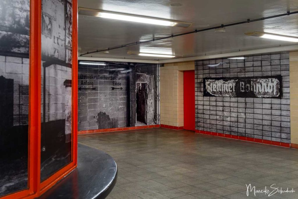
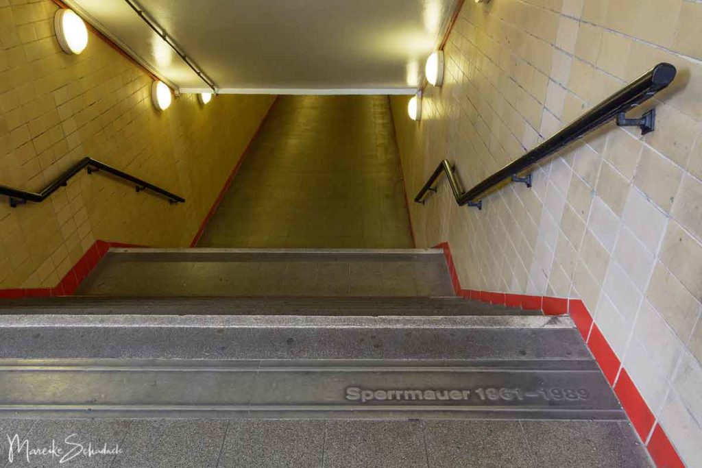
#5 Border and Ghost Stations in divided Berlin
During the division of Germany, several underground and suburban railway stations in Berlin became ghost stations. The trains of today's U-Bahn lines 6 and 8 and the north-south connection of the S-Bahn then passed under East Berlin without stopping. They slowly drove past the abandoned and closed stations - although - they were not that abandoned. Here, too, armed border guards made sure that nobody used the underground railway tunnels to escape. This certainly made the ghost stations a bit scarier.
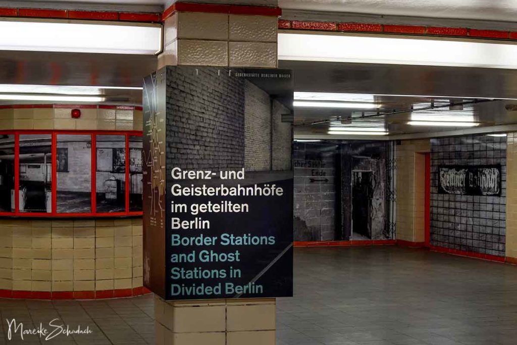
The Nordbahnhof was one such ghost station. Here, the exhibition Ausstellung “Grenz- und Geisterbahnhöfe im geteilten Berlin” is located on a mezzanine floor (entrance Gartenstraße; free admission).
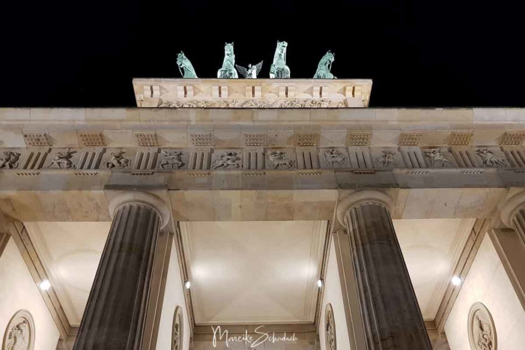
#6 Brandenburg Gate - Symbol for the Division of Germany
The former city gate and landmark of Berlin stood in the middle of the border strip during the division of Germany in the Soviet sector. Pariser Platz was also part of the border strip. Both were inaccessible to GDR citizens. For foreign guests, however, an information centre was set up in one wing of the Brandenburg Gate. The Brandenburg Gate became a symbol of a divided Germany. Today, an exhibition in the underground station Brandenburger Tor (U55) informs about its history.
#7 Checkpoint Charly
There is always a lot going on at Checkpoint Charly. Next to the East Side Gallery it is the most visited place at the former border and is also one of the most famous sights of Berlin. Since 2000, the replica of a former control barrack of the so-called foreigners' border crossing has been standing here. The portrait of a border guard still watches over this place and a large sign warns against leaving the American sector.
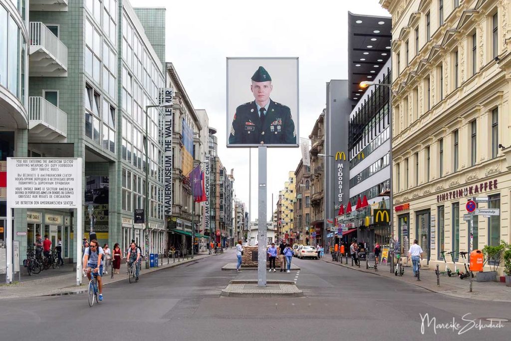
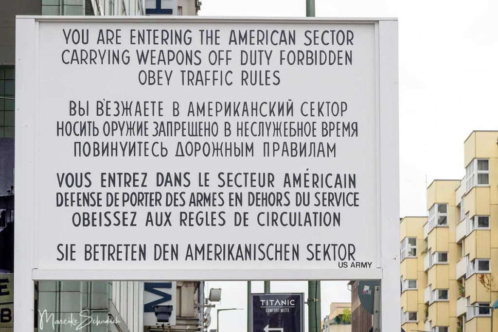
But here at Checkpoint Charly there is even more to see: The open-air exhibition Checkpoint Gallery documents the history of the border crossing with large-format photos. The Wall Museum and the Cold War Black Box invite history fans to visit. panoramic picture of Yadegar Asisi transports the visitor into a fictitious autumn day of the 1980s. In addition, there are several souvenir shops offering GDR-specific souvenirs, such as Trabis or pieces of the Wall. As you can see, you could plan a whole day for this highlight of the Berlin Wall Trail.
Speaking of Trabants: Have you ever driven one? How about a Trabi-Safari* in Berlin? I once owned a light blue Trabant station wagon for a short time. The steering wheel gear shifting took a little getting used to.

You want to explore the former border on a guided tour? Then I can recommend the Insider Tour Cold War* (english + german) and a guided Bike Tour along the Wall in a small group* (german).
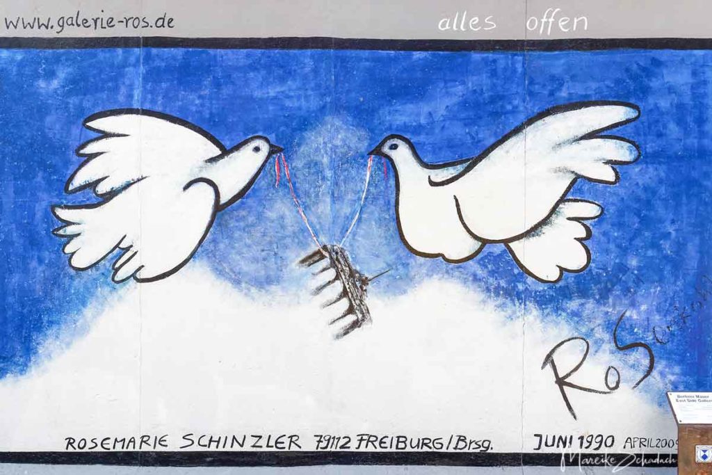
#8 East Side Gallery
The colourful side of the East Side Gallery - an expression of joy and hope
The East Side Gallery is the longest section of the wall still preserved, at about 1.3 kilometres. And certainly also the most famous. For the Wall between Ostbahnhof and Oberbaumbrücke is not only a testimony to history, but also the longest open air gallery in the world. So there are two good reasons for a visit. The Berlin Wall Foundation offers public guided tours focusing on history or art.
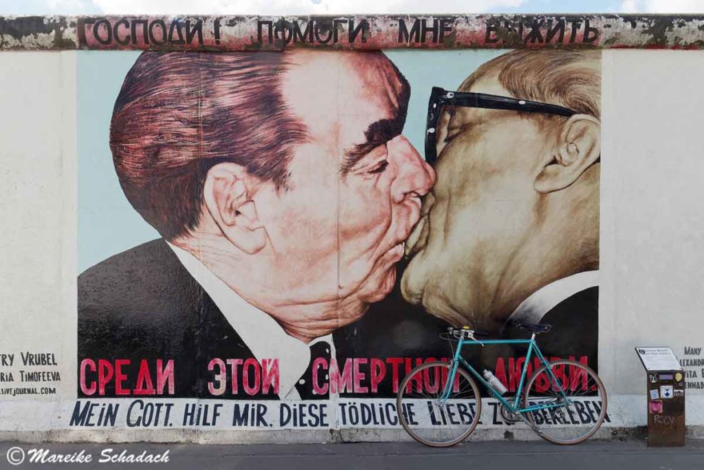
The East Side Gallery was built after the opening of the Berlin Wall between spring and autumn 1990. 118 artists from 21 countries painted the then grey concrete wall with 106 works of art. And thus saved the Wall from demolition. In their paintings, the artists expressed the political changes of 1989/90 and their joy over the fall of the Wall. In November 1991, the wall and its paintings were finally listed as a historical monument. However, environmental influences and overpainting caused the paintings to suffer. After minor restoration measures, a complete restoration finally took place in 2009. The works of art were removed and the respective artists were asked to repaint their paintings with more resistant colours.
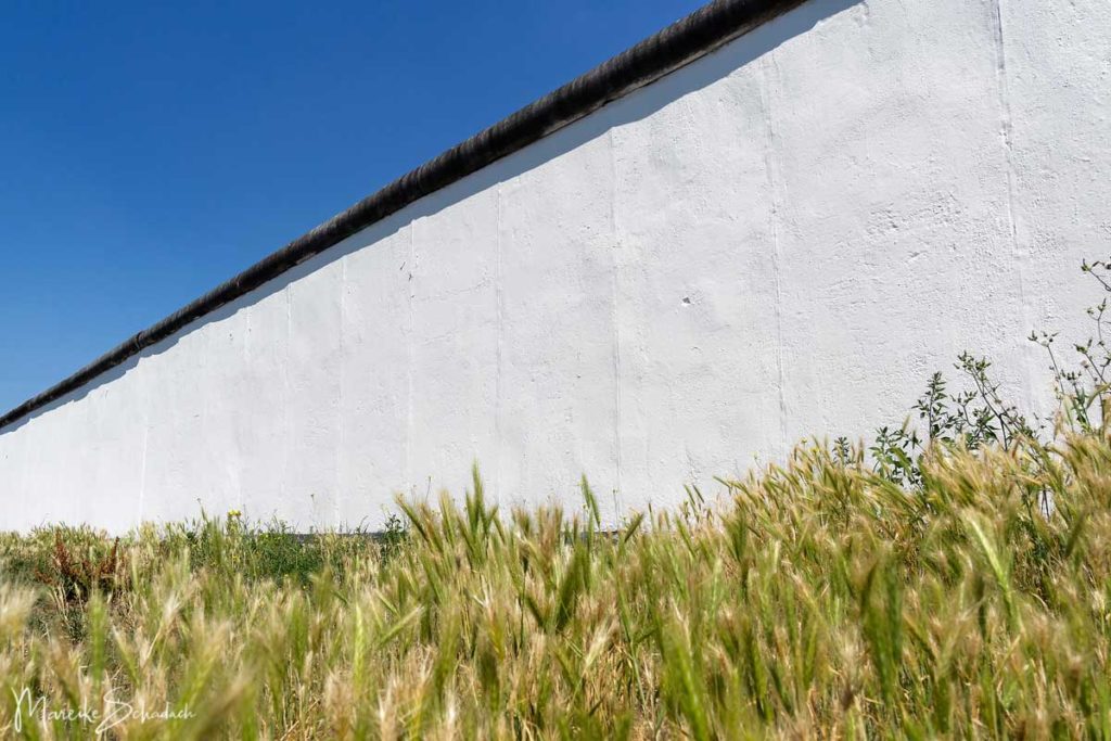
The white side of the East Side Gallery - a shadow catcher
The side of the East Side Gallery facing the Spree River was recently painted white. At first I interpreted this as preparation for new works of art. But I was completely wrong. The East Side Gallery has been restored to its original pre-1989 condition. In its function as a barrier element, this side of the wall had been painted light-colored since the 1980s. The border guards were supposed to be able to see the shadows of people fleeing more easily. The historical condition of the Wall should be made visible to the visitor again and contribute to a deeper understanding of this place.
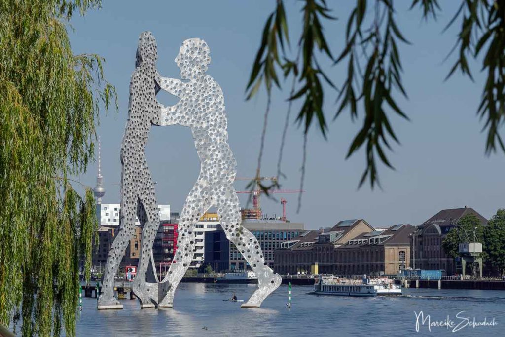
#9 Check Point for Vessels and Molecule Man
The "Molecule Man" by Jonathan Borofsky can be seen from far away. He stands for the growing together of the three districts Friedrichshain, Treptow and Kreuzberg and is a great photo motif. In the background you can see the remains of the former check point for vessels. The approximately 500-metre-long footbridge for customs clearance dating from 1962 still exists and, like all border fortifications, is now a listed building. It was here that a spectacular escape was made: twelve GDR citizens reached West Berlin on a pleasure boat.
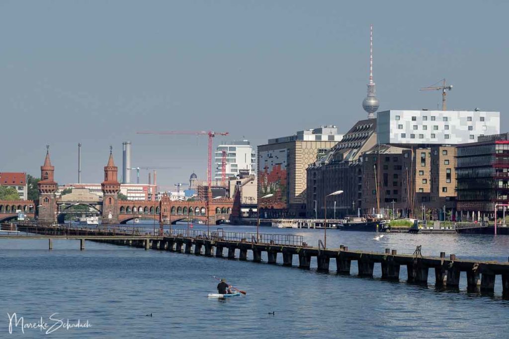
From here you also have a good view of the beautiful Oberbaum Bridge. The border crossing over the Oberbaum Bridge was only allowed to be used by pedestrians at that time.
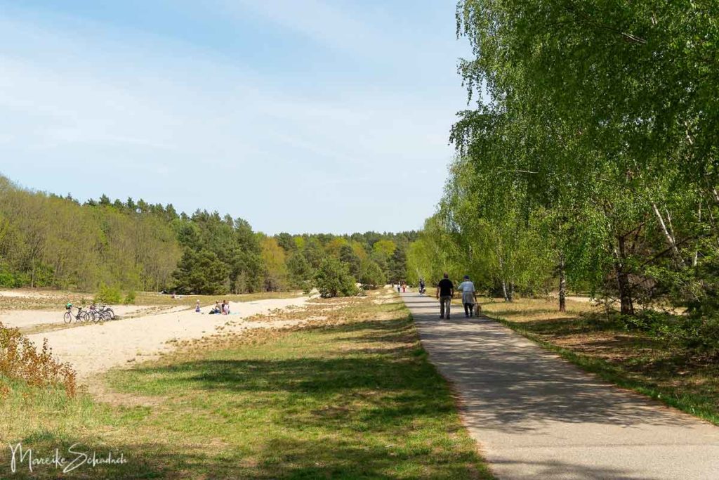
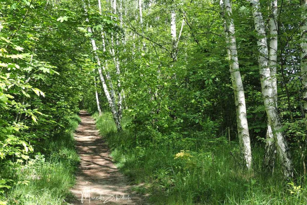
#10 The southern Route of the Mauerweg: wide Fields and Birch Groves
The southern part of the Wall Trail from Schönefeld to Lichterfelde Süd is ideal if you want to get out of Berlin into the countryside. From the path on the outskirts you usually have a wide view over the fields outside the city. In addition to the paved bike path, there is usually an unpaved path for hikers.

The route also has two highlights somewhat apart from the actual route: from the viewpoint of the former landfill you have a great view of the outskirts. The "Dörferblick" (village view) at Rudow also offers you a great view. But the most fascinating thing about this hill is its butterflies. In spring you can watch the beautiful yellow-black swallowtails with great certainty.
Hiking boots, daypacks and everything else you might need for a hike on the Berlin Wall Trail can be found at Bergzeit*.
#11 Around the Border Checkpoint Dreilinden
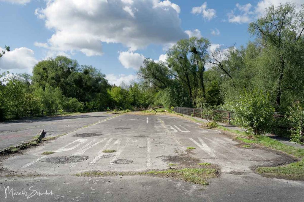
The Berlin Wall Trail from Lichterfelde Süd to Griebnitzsee is a highlight for all fans of Lost Places. Here you can discover two abandoned places. The border checkpoint Dreilinden on today's A115 and the original border checkpoint Dreilinden near Teerofenbrück with the remains of the former motorway route. At that time the highway was too close to the inner German border. Therefore, it was relocated. The border control point was also newly built and is known as Checkpoint Bravo. Its red-blue-yellow pop-art rotunda was a strong contrast to the gray border installations of the GDR. It was opened in 1973. Since 2002, however, the entire Dreilinden rest area has been abandoned and has decayed.

There is not much left of the former Dreilinden border inspection post. An old motorway bridge, remnants of the motorway, markings and pedestrian paths, a three-mast flag system and the old service building. You can find out more about the two former border checkpoints in my article Lost Places in Berlin and Brandenburg. After you have crossed the former highway bridge over the Teltow Canal, you can also run along the old highway route parallel to the Mauerweg. This has been dismantled, but is still clearly recognizable from the terrain formation.
#12 Section Griebnitzsee to Wannsee
The Wall Trail between Griebnitzsee and Wannsee was one of the most beautiful for me. A little bit like vacation and perfect for a nice summer day. There are also many great opportunities for side trips to other interesting places. So prepare for a long day. There are also lots of great places to stop for a refreshment. And don't forget your bathing suit!
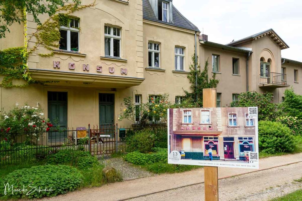
From the Griebnitzsee S-Bahn station, the route first leads along the lake to the Klein Glienicke park bridge. The border facilities were located on the southern shore of the lake, which had been expropriated for the construction of the border. Today there are impressive villas. Unfortunately, their plots mostly reach down to the water, so there is only a short walk at the shore. Klein Glienicke is located behind the park bridge. At the time of the division, the place was only accessible via this small bridge with a special pass. At one of the houses you can still see the faded red advertising of a former consumer - the supermarket chain of the GDR.
The Wall Trail then leads you past the Glienicke Bridge and along the banks of the Havel. From here you have a view of the Sacrower Heilandskirche and the Pfaueninsel. Side trips are worthwhile. Behind the Pfaueninsel, the Mauerweg then runs on the Pfaueninselchaussee to Königstraße. This is not particularly exciting, especially since there is also traffic here. Alternatively, you can walk through the Grunewald forest and enjoy the peace or simply continue along the riverside path.
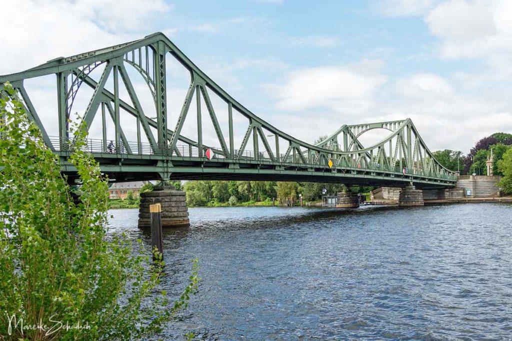
#13 Glienicke Bridge aka "Unit Bridge" or "Agent Bridge"
In 1660 there was a bridge on the site of today's Glienicke Bridge, which connected Berlin and Potsdam. Shortly before the end of the Second World War, the Glienicke Bridge was blown up by German soldiers. The Soviet troops temporarily built a pontoon bridge. It was not until December 1949 that the bridge was restored and henceforth had the name “Brücke der Einheit” - as a reminder of the unity of the anti-fascist parties. But in 1952 it was closed and was only passable with a special pass. The “Bridge of Unity” was now part of the border that separated Berlin and Potsdam. As an “Agentenbrücke” , it finally became a mystical place of the Cold War. This was because agents were exchanged between east and west over the bridge.

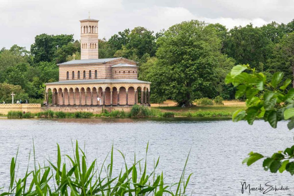
#14 Sacrower Heilandskirche
The Sacrower Heilandskirche gives a nice picture. It is difficult to imagine that the border between East and West Berlin ran across the church grounds. The bell tower was part of the border wall. The services were stopped in December 1961, the church in the no man's land fell into disrepair. But donations from the West at least made it possible for the church to be preserved externally. The interior of the church has now been restored and is available for church services, weddings and concerts. If you want to visit the church, you can take the ferry from Krughorn.
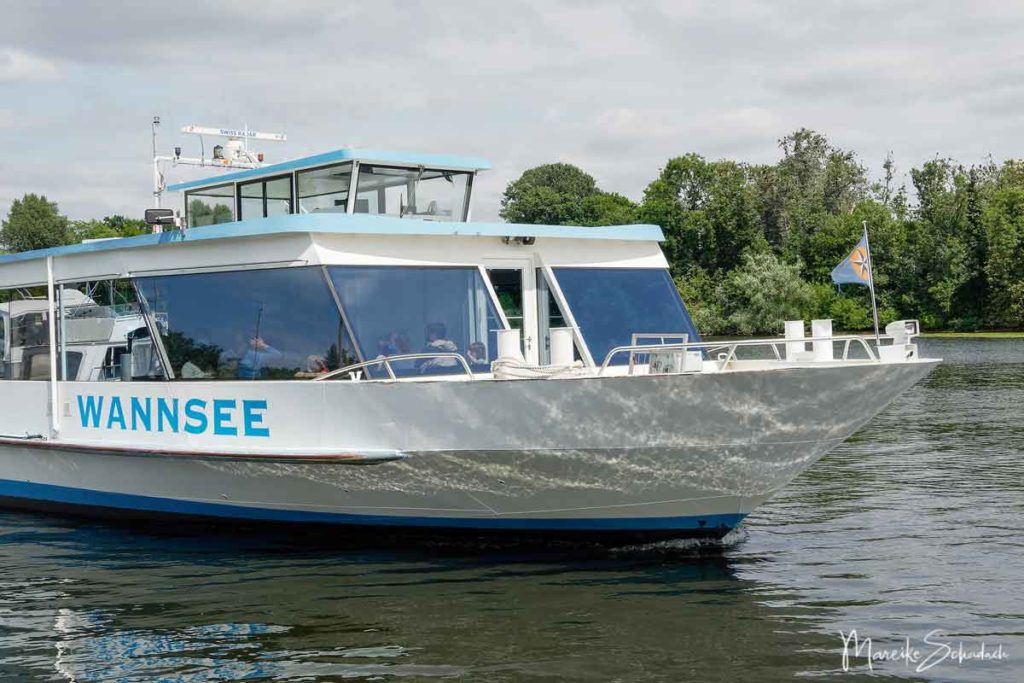
#15 With the Ferry from Wannsee to Kladow
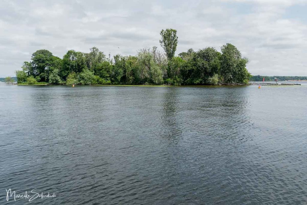
The ferry crossing is especially attractive in summer. Many sailing boats and paddlers are on the water. You also have a great view of the villas on the shore, the marinas and the Wannsee lido. Shortly before the ferry reaches Kladow, it passes the tiny island of Imchen. Hundreds of cormorants live here. The trees that carry their nests are dead and bare. Even if the cormorant colony is not popular with everyone, the birds are under protection and the whole island is a nature reserve.
Book Recommendations for Berlin Explorers
If you want to go deeper and learn more about the Berlin Wall, I can recommend the following books. Click on the picture to get to Amazon, where you can order the books. If you buy something through one of these affiliate links, I get a small commission and you help me to keep filling Fernweh-Motive with interesting articles. The product will not be more expensive for you.


Did you enjoy my article on the highlights of the Berlin Wall Trail? Then follow me on Facebook, Pinterest or Instagram. I would also be very happy if you share my article with your friends. Do you have any questions or suggestions? If so, please write me a comment!
More Berlin articles to read on
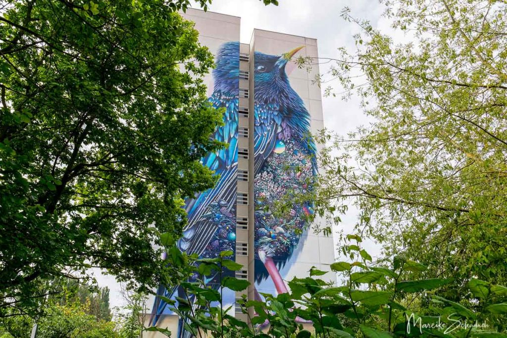
You want to discover more of Berlin? How about Berlin's Lost Places or a trip to the Graffiti Skyscrapers in Art Park Tegel?